
Iron Over the Hudson: Adaptive Reuse and Public Space on a Gargantuan Scale
 The Walkway over the Hudson as seen from Poughkeepsie.
A Mark on the Land
No matter where you stand along the waterfront of Poughkeepsie, NY, the colossal lattice of iron and steel is impossible to miss. It commands the landscape, towering over the skyline of this small Hudson River city as it vaults across the water's wide expanse. The gargantuan structure is so large it almost seems to form a wall dividing the mammoth river valley. Even here, some 80 miles (130km) north of New York City, the Hudson River remains startlingly wide. The crossing, however, manages to draw a straight line across the top of the riverine canyon, connecting the cliff tops on one side to the high bluffs on the other. The result is a structure that, from river level, feels preposterously tall—especially given its immense length and scale. Gazing up, the iron edifice feels like the apotheosis of the late-Victorian industrial age. Its eye-beguiling dazzle of trusses seems to stand as a testament to the power of human ingenuity to brute force its way across any chasm, no matter how wide. At the same time, however, for all its bravado, the structure still somehow feels right at home amongst the steep hills and dense forests of the Hudson Valley. Perhaps the crossing simply needed all the dramatic might it could muster to stand up to the ostentatious natural majesty that surrounds it.
This immense mass of girders is—or at least, was—the Poughkeepsie Railroad Bridge, and it stands as a true landmark in every sense of the term. With a length of 1.3 miles (1.2km) and a height reaching 212 feet (65m) above the river below, the structure is an inescapable visual presence. For nearly a century, it was a vital link in America's freight rail network: the only place south of Albany—the state capital some 150 miles (240km) north of New York City—that heavy freight trains could cross the Hudson River. Between its size, its presence, and its import, the bridge has been something of a symbol of Poughkeepsie from the day it opened. The crossing's productive career, however, would come to a sudden and ignominious end in 1974. Left abruptly purposeless, the bridge would sit abandoned for nearly 35 years, left to rust away in the sky like a relic of a long-lost civilization—a titanic elegy to an industrial economy that was no more.
Today, however, nearly fifty years after the last freight train rumbled across its trusses, the bridge has been given a second life as a peculiar but wonderful piece of the public realm. Now named the Walkway over the Hudson, it has been rebuilt as a pedestrian promenade and viewing platform. With stunning views and a unique appeal—in addition to its history, it was, up until very recently, the longest pedestrian-only crossing in the world—the Walkway has proven a very successful tourist attraction 1. Unlike so many other touristic renovations, however, the Walkway is no carnival pastiche designed to separate visitors from their money. Instead, it operates as a truly public space, one that finds its uniqueness almost as much in its symbolic resonance as it does in its value as a day-to-day amenity. Obviously it's hard to generalize from endeavors as unique as the Walkway over the Hudson: most cities do not have a spare, out-of-service viaduct with gorgeous views just lying around waiting for a purpose. At the same time, however, the successful conversion of this old railway bridge to suit a new era does hold lessons, both for cities seeking to reinvigorate their public realm as well as for students of urbanity to help understand how people understand and connect with the places they inhabit. Ultimately, the Walkway over the Hudson stands as testament to the galvanizing and generative power of well-executed adaptive reuse, even—or perhaps especially—when undertaken on the most gargantuan of scales.
A Vital Link, Severed
 The Poughkeepsie Railroad Bridge circa 1897-19042.
When it first opened in 1889, the Poughkeepsie Railroad Bridge was something of an engineering marvel. It stood as the first permanent span of any sort to cross the Hudson River south of Albany. Given the river's massive width, the steep, rocky terrain that lines its banks, and its general business—the Hudson is navigable by ocean going ships all the way up to the Port of Albany—this was no small feat. Indeed, the crossing would stand alone as the southernmost crossing of the river all the way until 1924, when the Bear Mountain Bridge—at the time, the longest suspension bridge in the world—opened some 30 miles (50km) downstream.
Prior to the opening of the Poughkeepsie Railroad Bridge, there was no direct rail connection between southern New England, southeastern New York, and the rest of the country. Instead, rail traffic that needed to cross the Hudson had no choice but to either make a long detour upriver or else be ferried across the water by New York City's mammoth army of car floats—a slow, laborious, and often expensive process. For passengers, the situation would improve in 1910, when the Pennsylvania Railroad completed a pair of new tunnels under the Hudson River. Designed to feed people into and out of the company's monumental new Manhattan terminal, these tubes were a major technological achievement in and of themselves: they were not only fully electrified, but also able to carry full-sized railroad cars. The tunnels were not, however, designed for heavy freight traffic. At the time, the logic was that while passengers might object to the time needed to transfer to cross-river transportation, cargo was rarely so time sensitive. Perhaps more importantly, compared to passengers, cargo was comparatively low yield, and the tubes were already heavily scheduled for use by comparatively lucrative passenger trains 3. This left the Poughkeepsie Bridge in an important (and often lucrative) position: it could offer freight traffic an easy route across the water that didn't necessitate either a long detour or expensive, time-consuming barging.
By the late 1950s, however, the Poughkeepsie Bridge—like much of the nation's freight rail network—was in trouble. Long distance trucks traveling over the nation's new Interstate Highway System had begun to capture an ever larger portion of the freight market. Making matters worse, the New England states were already beginning to deindustrialize—a process which generally began with the heaviest industries first. This decline all but eliminated traffic in commodities like coal and steel, the bulky, low-yield, high-volume staples that had fueled freight revenues for most of railroad history. The situation for the bridge truly turned dire, however, in 1968. That year, in an act of desperation, most—but not all—of the Northeast's railroads merged into a single company, the massive Penn Central. This new conglomeration immediately began seeking to lower costs by rationalizing rail routes, eliminating lines which competed directly with one another and funneling traffic into a smaller number of key corridors. Unfortunately for the Poughkeepsie Bridge, however, one of the railroads that was left out of the merger just so happened to be crossing's primary western outlet: the Lehigh and Hudson River Railway. As a result, even though Penn Central now owned the Poughkeepsie Bridge, it had little interest in operating it. Instead, the company preferred to keep its traffic (and revenue) completely in its own network, diverting most freight to its then-new Selkirk yard outside Albany. This left the Poughkeepsie Bridge something of an orphan, reduced to serving local customers only. What had once been a constant flow of trains slowed to a trickle, before eventually bottoming out at only a single train per day in each direction 4.
Given the already dire financial straits of Penn Central, this collapse in revenue translated directly into deferred maintenance. As a result, when the sparks of a passing freight train set fire to the bridge's wooden ties in May of 1974, firefighters would quickly learn that the standpipe designed to help slow its spread no longer functioned5.
The fire was intense and—thanks to its remote, high-altitude location—frustratingly difficult to extinguish. The flames burned for hours, doing significant damage to the nearly century-old structure. Although the bridge would remain standing, it would require extensive repairs if it were ever to carry the weight of heavy freight trains again6. Unfortunately, by this point, the beleaguered Penn Central just so happened to be in the middle of one of the largest corporate bankruptcies in American history. The company was already finding it difficult to cover the costs of regular maintenance; finding the funds to repair an expensive bridge along a lightly-used freight line was out of the question. Even had funds been plentiful, however, the situation probably would not have changed much: the general sentiment among railroad people at the time seemed to be that the Poughkeepsie Bridge's time had already come and gone. This attitude was born out only two years later, when government officials finally put together a plan to help finance repairs. Not only would Penn Central's successor, the government-owned Conrail, refuse to participate in any reconstruction, it also went as far as to refuse to guarantee a regular flow of trains should the money be found to restore the crossing7. This wasn’t simply intransigence: the previous decade had seen a concerted attempt to move freight off of the Northeast Corridor and onto duplicative lines in an effort to speed passenger service8. The bridge, however, had always been firmly oriented towards bringing freight into the former New Haven Railroad’s Cedar Hill Yard—located in its namesake city—and from there, onto the Corridor. There is an argument to be made that perhaps a more robust system of national freight rail planning—one more interested in maintaining freight service between smaller customers and promoting it as an alternative to trucking—might have changed the situation, and found a new role for such a unique link. Without it, however, the Poughkeepsie Bridge's fate seemed sealed.
Thanks to both the fire and Penn Central's planning decisions, ever since 1974, all freight traffic seeking to make its way across the Hudson River between New York City, southern New England, and the rest of the Eastern Seaboard across the Hudson River has been forced to either make a long detour up to Albany, be floated across the water on a shrinking number of car floats, or more often than not, simply travel by truck over the region's bridges and tunnels. The long rail trip through Albany is now so infamous that, in planning circles, it has a name: the "Selkirk hurdle." To this day, all goods traveling between New York City and points south along the Atlantic coast—including to or from the city's major port in Newark, NJ—all but require a 300 mile (480km) round trip detour to travel by rail. As a result, freight rail service in New York City proper tends to be difficult, expensive, and rare.
Finding Purpose
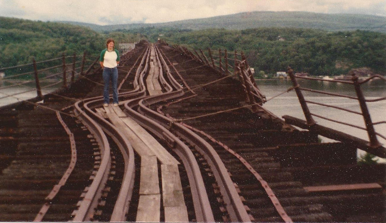 The abandoned Poughkeepsie Railroad Bridge in 1981, showing the extreme fire damage9.
Meanwhile, after repair plans fell through, the mammoth Poughkeepsie Railroad Bridge itself sat all but abandoned, too expensive to tear down but not economical enough to return to service. Aside from a short-lived attempt to use the structure to carry long-distance electric transmission lines, there were few concrete plans for its future 10. As a result, for nearly thirty-five years, the monumental structure quite literally hung over the City of Poughkeepsie's head, less an ever-present sword of Damocles and more an inescapable reminder of an age lost to time. What had once stood as an icon of industrial progress was now reduced to a visual synecdoche for seemingly inexorable decline. What had once been the symbol of a prosperous city now seemed to represent only loss and decay: the deindustrialization of the Northeast, the collapse of America's rail network, and the decline of small cities like Poughkeepsie itself.
For the poetically-inclined, there was undoubtedly something romantic about a mammoth iron ruin slowly rusting away above a decaying city: it is an elegiac symbol of industrial decline nonpareil. Understandably, however, many of the actual denizens of Poughkeepsie were not exactly thrilled with the idea of their town taking on a permanently funereal air. If outside forces could not bring the city's icon back to life, then residents would have to take on the task themselves—or so the argument went amongst a certain group. Towards the end of the century, these inhabitants would come together to form a grassroots organization that they called Walkway over the Hudson. Their proposals centered on a radical plan: to repurpose the derelict crossing for two new public uses: recreation and tourism11.
Recreation only seemed a logical place to start. By the late 1990s, the rail routes that had once fed the bridge had already followed the path blazed by so many old freight lines across the country and been converted into successful rail trails. If the bridge could be made into a pedestrian trail, it would not only link these two hiking paths into one continuous scenic route, but would also make the hike that much more attractive by creating a stunningly unique perch from which to take in the Hudson Valley.
Some of the Walkway's promoters, however, were also beginning to dream bigger dreams. Since the Poughkeepsie Bridge was already a notable local landmark, they argued, perhaps there was a way it could be made into a regional, national, or even international attraction. After all, so the logic went, similarly iconic structures like the Eiffel Tower and the Golden Gate Bridge were already massive tourist draws all on their own. Perhaps a revitalized railroad bridge could become something similar, attracting visitors to the Hudson Valley while giving downtown Poughkeepsie a much-needed economic boost12.
This was ambitious rhetoric, to be sure—especially for a small city of less than 75,00013. It also just so happened to mirror a far more well-known conversion happening downstream. At almost the same time that these plans were being drawn up, a similar proposal to turn a defunct freight rail line on the West Side of Manhattan into an elevated park was just beginning to gather steam. New York City's High Line, of course—which itself also began as an amateur project—would go on to massive acclaim, creating a fad for repurposing any old piece of industrial infrastructure into park space that continues to this day. The Walkway over the Hudson, of course, was no imitator: with the opening of the High Line still more than a decade away, the projects were peers. What's more, even had the High Line existed as a template, its applicability to Poughkeepsie would have been an open question. After all, the High Line stands in the middle of a tourist mecca, not in a distant town on the edge of the commuter belt. In the moment, it was more than reasonable to wonder how much of the Walkway plan was actually achievable and how much was the product of delusional boosterism. Could an expensive pedestrian bridge in the middle of the Hudson Valley actually attract enough interest to be worth the effort?
Whatever doubts observers might have had about the project, though, its organizers would soon get the opportunity to put their dreams to the test. In 1998, the bridge's owners—after failing to pay taxes on the structure and seeking a way to escape liability—decided to sell it to the non-profit for a nominal $1. For the Walkway organization, the most challenging part of their plans must have seemed complete: the bridge was in hand. As the conversion began in earnest, however, progress proved painfully slow. For all its energy, at this point the Walkway organization was still largely an enthusiast effort, and it was having a great deal of difficulty obtaining both the permits and the cash that a conversion on this scale would require. To actually pull off a project of this size, the organization would need to professionalize, and quickly14.
It would find the experience it was looking for in the form of Fred Schaeffer, a local Hudson Valley lawyer. Schaeffer had already cut his teeth in both the public space and philanthropic worlds by overseeing the creation of the rail trails that lead to the bridge. Under his leadership, the difficult job of fundraising could begin in earnest. Transforming the bridge into a public space would prove an expensive endeavor, eventually costing nearly $40 million to complete. Schaeffer, however, was able to find two major partners willing to cover the bulk of the cost. First was the Dyson Foundation, a Hudson Valley charity set up by a retired expert in leveraged buyouts with a goal of benefitting the region. The second was the State of New York itself, which was always on the lookout for ways to boost upstate tourism. Still, even with this funding in hand, the budget was tight, especially as the aftershocks of the 2009 financial crisis sent construction and material costs like steel skyrocketing. In order to actually complete the project, the Walkway organization would have to scale down its plans, narrowing the proposed path by a full 10 feet (3m) and delaying whatever other park elements they could until more funds could be secured. Their perseverance, however, would ultimately pay off, and a little over a decade after the group took possession of the bridge, on October 3rd, 2009, the finished Walkway over the Hudson opened to the public15.
From the moment its gates opened, the Walkway was a runaway success. In fact, although the organization had originally projected some 267,000 people would visit during the crossing's first year of operation, more than 415,000 visitors would show up during its first three months alone16.
With success in hand, the Walkway organization could finally complete what Schaeffer called its "ultimate goal:" "...to give [the bridge's] title to the state"17. Just a few months after opening, the organization donated the entire crossing complex to the New York State Office of Parks, Recreation, and Historic Preservation, which would operate it as a state park. On a practical level, this ended the project's money woes. The state, for instance, was able to transfer the bridge itself to the New York State Bridge Authority, which had both the scale and expertise needed to provide specialized services such as insurance and heavy maintenance. At the same time, though, passing the ownership torch also allowed the Walkway organization to focus its resources on efforts it had previously deferred, such as building a structural lighting system and a public elevator to connect the crossing to the riverfront park below.
Practical matters aside, however, the handover was also simply a culmination of what the Walkway organization had set out to achieve. Poughkeepsie's grand landmark was now not only safe from demolition, but was also accessible to people in ways that it had never been before. By donating the complex to the state, the organization could rest assured that its creation would remain a truly public asset for years to come. There are always equity questions surrounding privately-developed, philanthropically-funded public space, but the Walkway directly served the comparatively poorer, more disadvantaged residents of downtown Poughkeepsie as well as more well off regional residents. For the Hudson Valley as a whole, the project could not have gone better.
More Than Tourism: The Walkway Today
The mass of visitors that descended on the Walkway over the Hudson during its first months all but confirmed that the project had succeeded in its most unlikely goal: the bridge was now a successful tourist attraction. By any measure, this was a major achievement, especially for a city with an economically depressed core like Poughkeepsie. At the same time, however, if the Walkway had only succeeded as a tourist magnet, it might be easy to write off as a shallow victory. As a group, tourists can be a fickle and capricious lot, and when travel tastes change, they can change quickly, sometimes wiping established destinations off the map overnight. What's more, as the bridge's sibling—the High Line—has made clear, too much success with tourists can sometimes overwhelm a place, rendering it either too crowded or too unpalatable for local residents. Ultimately, the refurbished Poughkeepsie Bridge was never going to be either a mere tourist destination or simply a scenic viewpoint in the middle of a hiking trail. Simply by virtue of landing in the middle of Poughkeepsie, it was also always going to be tested as an urban public space.
Thankfully, this role had always been a central part of the Walkway organization's vision. For all of the group's grandiose talk of making a mark on the world stage, the renovation was always centered first and foremost on two factors: preserving an abandoned local landmark, and reshaping it to serve the community in a way it never had done before. As a result, although the organization often dreamed of a tourism-driven economic revival, it never lost sight of its original goal: to sculpt a new piece of public space infrastructure for the Hudson Valley18. And happily, a trip across the Walkway over the Hudson today reveals that, in this too, the organization succeeded, crafting a space that not only attracts tourists, but also serves and enhances the local public realm, as well.
The massive bridge touches down right in the middle of one of Poughkeepsie's surviving urban neighborhoods. In many ways a rust belt city at its core, much of central Poughkeepsie has seen better days, pockmarked by the accumulated scars of not just age, but disinvestment, deindustrialization, and suburbanization. That said, although the area surrounding the base of the Walkway is clearly a bit rough around the edges, the neighborhood (like much of the rest of the city) nonetheless continues to endure as a functional urban community.

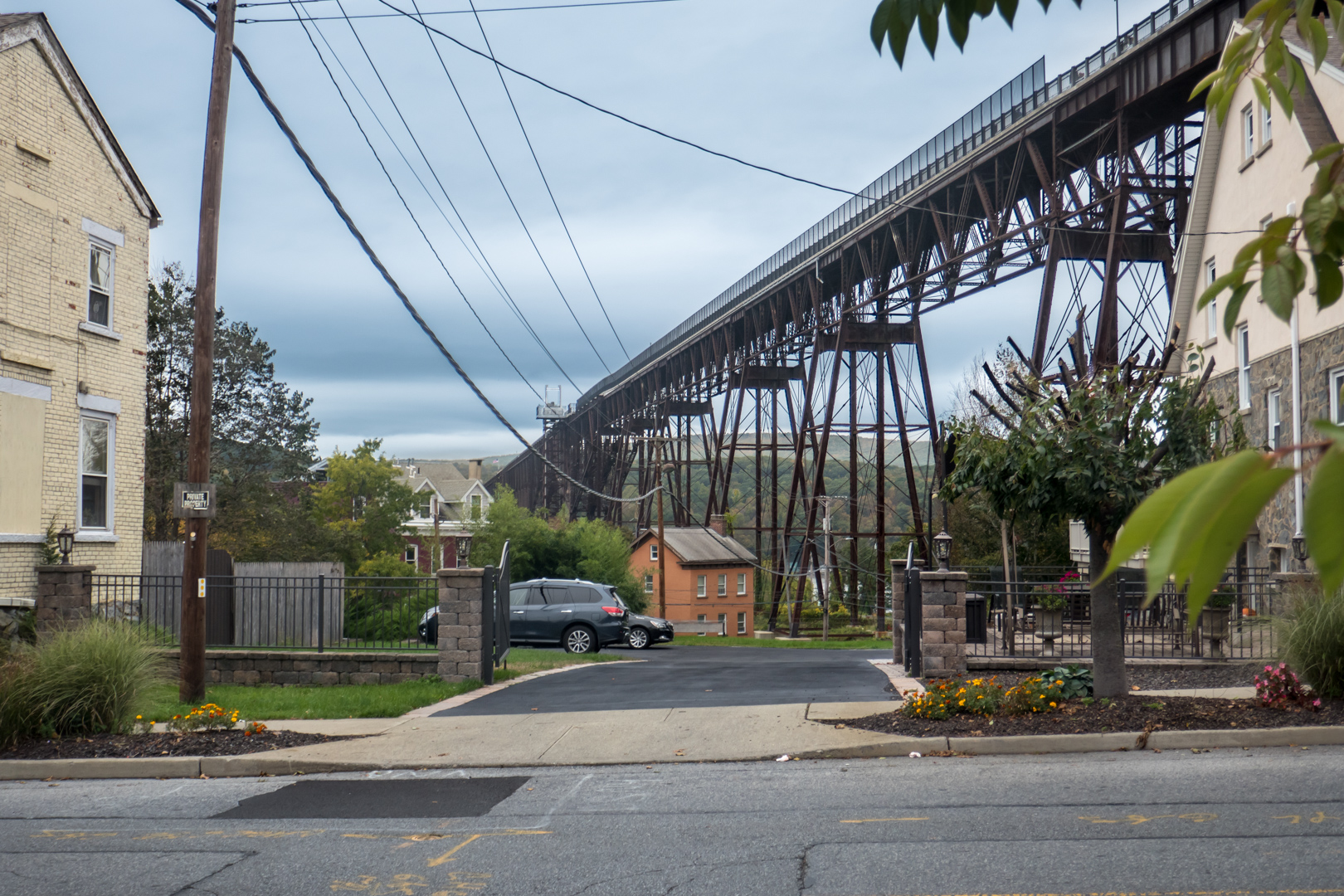
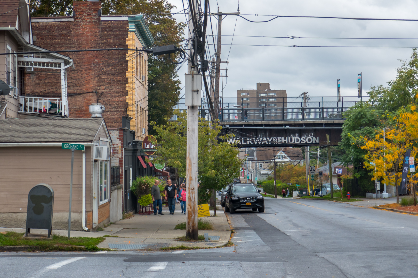
The bridge itself sits nestled deep into the urban fabric, tucked in between shops, restaurants, and gorgeous Victorian homes a little worse for wear. Approaching on foot from the north, with the bulk of the structure blocked from view, the small portion one can see above the road almost seems unremarkable at first: many once-industrial cities are laced with similar-looking rusted railway trestles. Even before you catch a glimpse of the rest of the gargantuan crossing, however, there are plenty of hints that this is no ordinary piece of forgotten infrastructure. For one thing, there's the heavy flow of people walking along the street—a crowd far larger than those that grace the sidewalks of the surrounding areas. At the same time, a varied group of businesses line the street—businesses which, like most urban storefronts, require a certain amount of heavy foot traffic to truly thrive. The final confirmation, however, comes by way of the local artists who have laid out their work under the bridge's abutment, and are busy hawking it to passing sightseers. Few things better indicate a successful tourist attraction more than an impromptu market like this.
 The Walkway from the street.
Next to the hucksters a set of new stainless steel stairs rises up to meet the old structure, providing access to the bridge itself. Reaching the top, you join a path already in progress, heading off in both directions. If you travel away from the water, you find a relatively level trail that continues inland for a few blocks to meet the city's rising hills. This route not only connects the crossing to the existing rail trail—which begins where the bridge ends—but also creates a fully accessible and bikeable route over the river. Meanwhile, heading in the other direction, the Walkway over the Hudson-proper begins, protected by a set of gates that allow it to be closed at night and during inclement weather. (I speak from previous personal experience when I say that, suspended some 200 feet in the air above a river valley, strong winds can be a frightening affair).
Leaving this small plaza and heading out onto the bridge itself, one of the first things you notice is the sheer number of people making the crossing. Even on a cold, overcast day in early Autumn, the Poughkeepsie Bridge is surprisingly well used, by a remarkably diverse group of people. An impressive cross section of humanity stretches out in both directions, made up of a vast array of individuals and groups, each traveling in their own ways, at their own paces, and for their own reasons19.
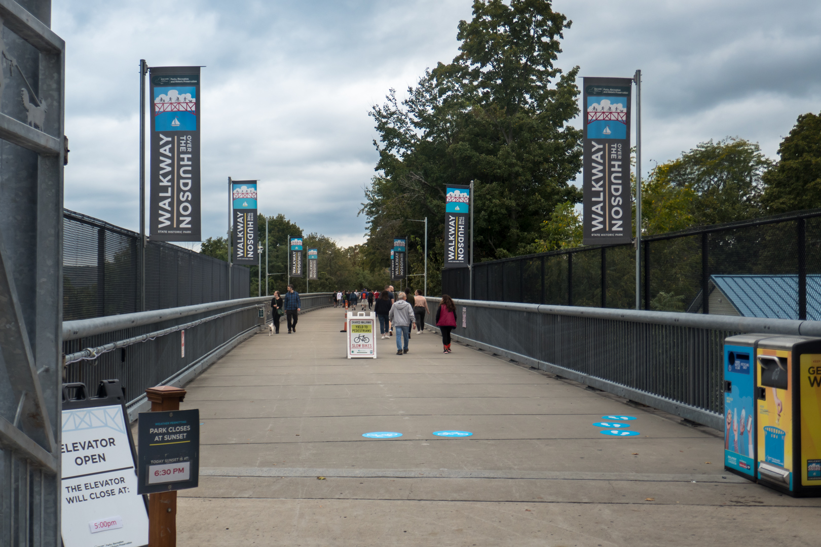 The start of the Walkway over the Hudson.
Moving the slowest of all these groups probably has to be the parade of young families, who stroll along leisurely as they push strollers or hold onto the hands of their young children. Largely out to make memories together, parents do their best to get their often flighty kids to take in the scenery, while also stopping at each and every historic display along the path to try and eek the most out of their collective experience. Walking just a hair faster are clusters of students from the various local institutes of higher learning—the Poughkeepsie area is home to Dutchess Community, Marist, and Vassar Colleges, as well as the Culinary Institute of America. Usually clumped together in small packs, the students amble along at an irregular pace, out here as much to talk, laugh, and bond with one another as to admire the views. A bit faster still are the small groups of adult friends out for walks, often traveling in pairs. While they seem to travel faster than the students, perhaps using the walk for exercise, most are still locked deep in conversation: the Poughkeepsie Bridge has clearly become a regular space for people to meet and pass the time. Traveling at about the same speed is another group happy to make the bridge their home: a steady stream of dogs, most of whom eagerly pull their human companions along behind them. Though most are clearly enjoying the open air and shallow grade, a spoiled few—tired from the long walk, one presumes—have somehow cajoled their owners into carrying them back in human arms. Moving yet faster are the small groups of elderly speedwalkers, who are busy motoring their way across the river for exercise and companionship. This is great to see as the traditional home of the speedwalker—the suburban shopping mall—seems to be slowly dying. Even if malls were healthy, however, one would have to figure that on a halfway decent day, the scenery of the Hudson Valley would give any shopping complex a run for its money. On the topic of running, however, we finally reach the fastest group of all: the joggers and bicyclists who use the crossing as an almost impossibly scenic exercise track. And happily, even though the Walkway had to be narrowed down during its design phase for budgetary reasons, the path always remains wide enough to allow these faster travelers to pass by comfortably, without interrupting anyone else.
 Different people on the Walkway over the Hudson.
This impressive panoply of people is a testament to the Walkway's success as both a public space and an urban place. There is, however, one final group of visitors left to mention, one which hammers home the Walkway's wide appeal: tourists—including international ones. Even though my initial visit came at the tail end of various Covid-related travel restrictions, as I traveled across the bridge, it was easy to hear languages from all over the world. When the crossing was first proposed, the occasional comparisons to structures like the Eiffel Tower or Golden Gate Bridge had to have seemed hopelessly optimistic at best (and outright foolish at worst)—even to those who generally supported the plan. But while the comparison is obviously still more than a bit hyperbolic, those who preached the gospel of the Walkway ultimately proved far more right than wrong: the former rusting hulk is now a bona fide tourist attraction, pulling in visitors from all over the world.
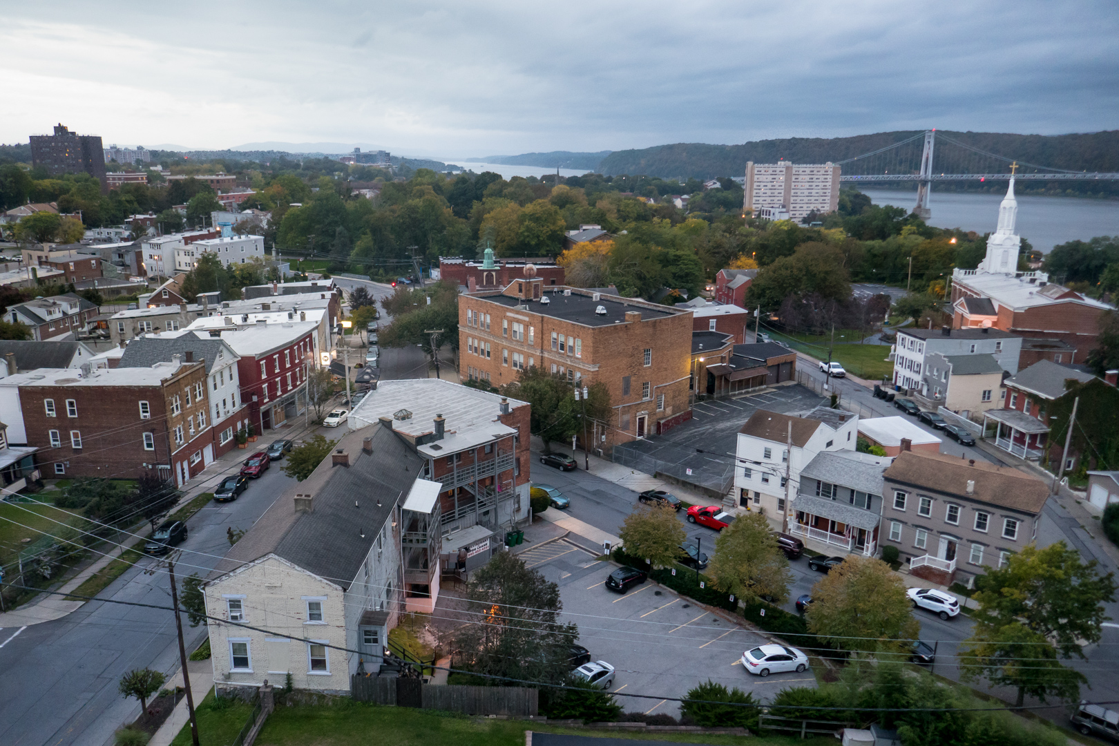 "For anyone with an eye for the urban, the view is a dream—a Google Maps 3D view come to life."
The Walkway, of course, owes the vast majority of this success to its stunning vistas of the Hudson Valley. The scenery begins—perhaps surprisingly—within the city of Poughkeepsie itself. Most of us have had a chance to revel at a bird's eye view of a city through the window of a tall building or from an airplane. The Walkway offers an experience that's similar, but more engrossing: a chance to glide over a city in the open air, at a low enough altitude to easily examine detail, and at a self-controlled, walking pace. In every direction, Poughkeepsie's fine-grained urban texture and diverse architectural vernacular are on full display. At times, it can almost feel like you're examining an impossibly detailed scale model of the town sitting on the table in front of you. From this vantage point, the educated eye can read much of the city's history, beginning at the remains of riverfront wharves and warehouses, continuing to the railroad tracks that supplanted the river trade, followed by the timeworn homes and shopping districts of what were once thriving immigrant communities, until finally arriving at the traumatic urban renewal of US Route 9, an expressway trench that was carved between the city and its waterfront. For anyone with an eye for the urban, the view is a dream—a Google Maps 3D view come to life.
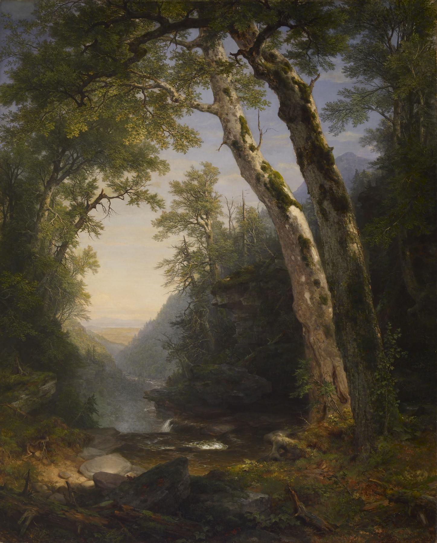 Asher Brown Durand’s The Catskills is exemplary of the Hudson River School20.
And all of that, of course, is only an appetizer for the river itself. While the United States is undoubtedly home to far taller peaks and far deeper canyons, the Hudson Valley has a grandeur all its own—one that can at times feel almost primordial. In part, this is cultural: the famous Romantic landscape paintings of the Hudson River School long ago rooted this landscape into the American psyche as the archetype of idyllic nature. Still, the actual experience of the landscape more than stands up to its deliberately emotive billing. To stand some 200 feet above the middle of the river and gaze upon the valley feels more than a bit like stepping into one of those paintings, and inhabiting one of the improbably expansive forest clearings that define the style.
Every direction brings its own unique vista. To the south, the shoreline twists and turns in tight, complex bends, each wrinkle carving massive coves into the steep mountain walls, creating folds that somehow seem to trap the light of sunset. To the north, in contrast, the Hudson travels in a fairly straight line, receding into the distance almost as far as the eye can see. The scale flummoxes the mind's sense of proportion: the river feels far too wide for something so long to possibly be. Meanwhile, the steep river bluffs of the western shore are covered by an intensely dense forest, completely blanketing the massive geology below. Over the tops of these cliffs, one can catch brief glimpses of the Hudson Highlands, a landscape of mountain peaks and valleys that seems to continue on into infinity. Put together, these views are—to put it mildly—spectacular.
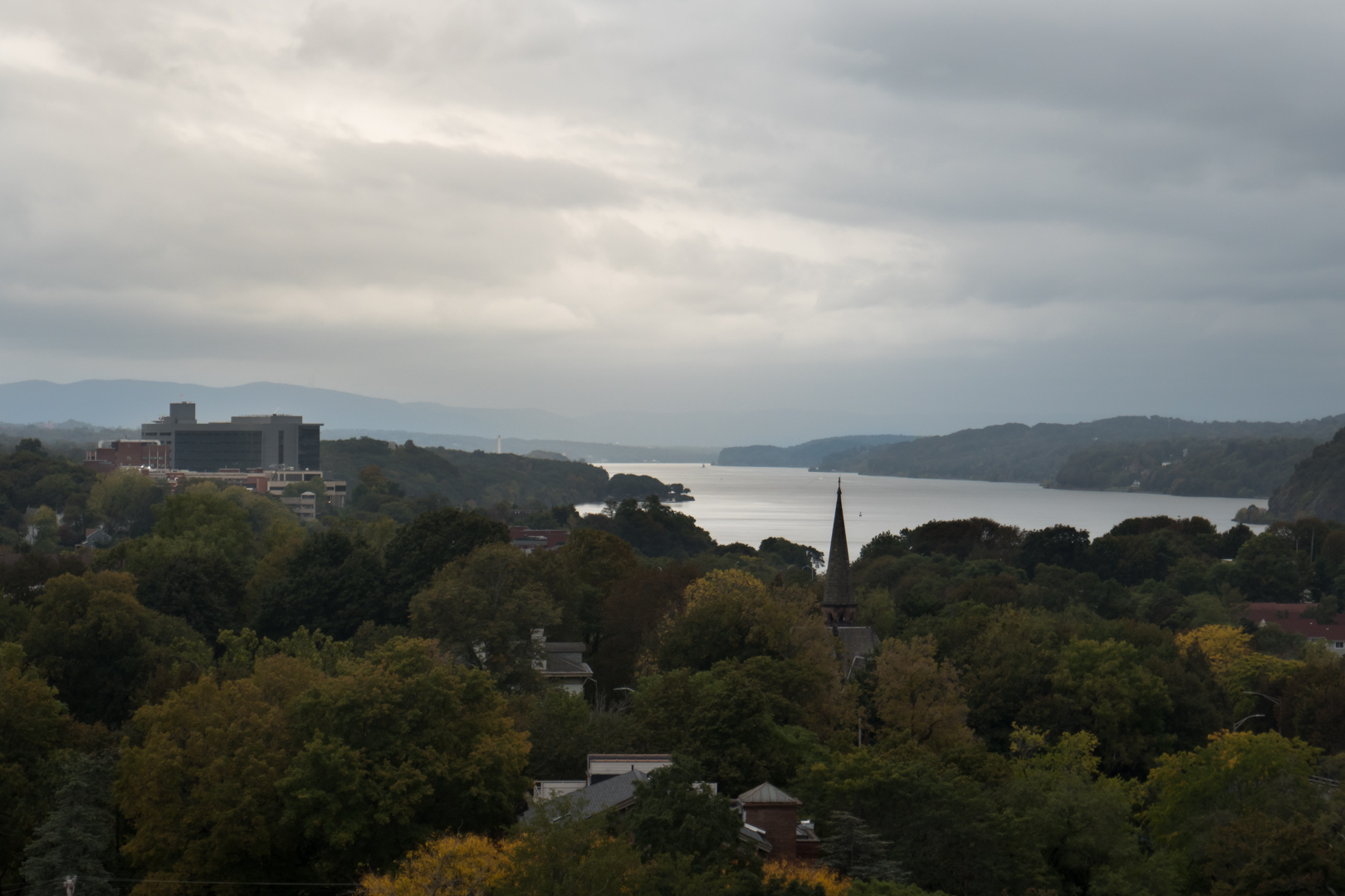
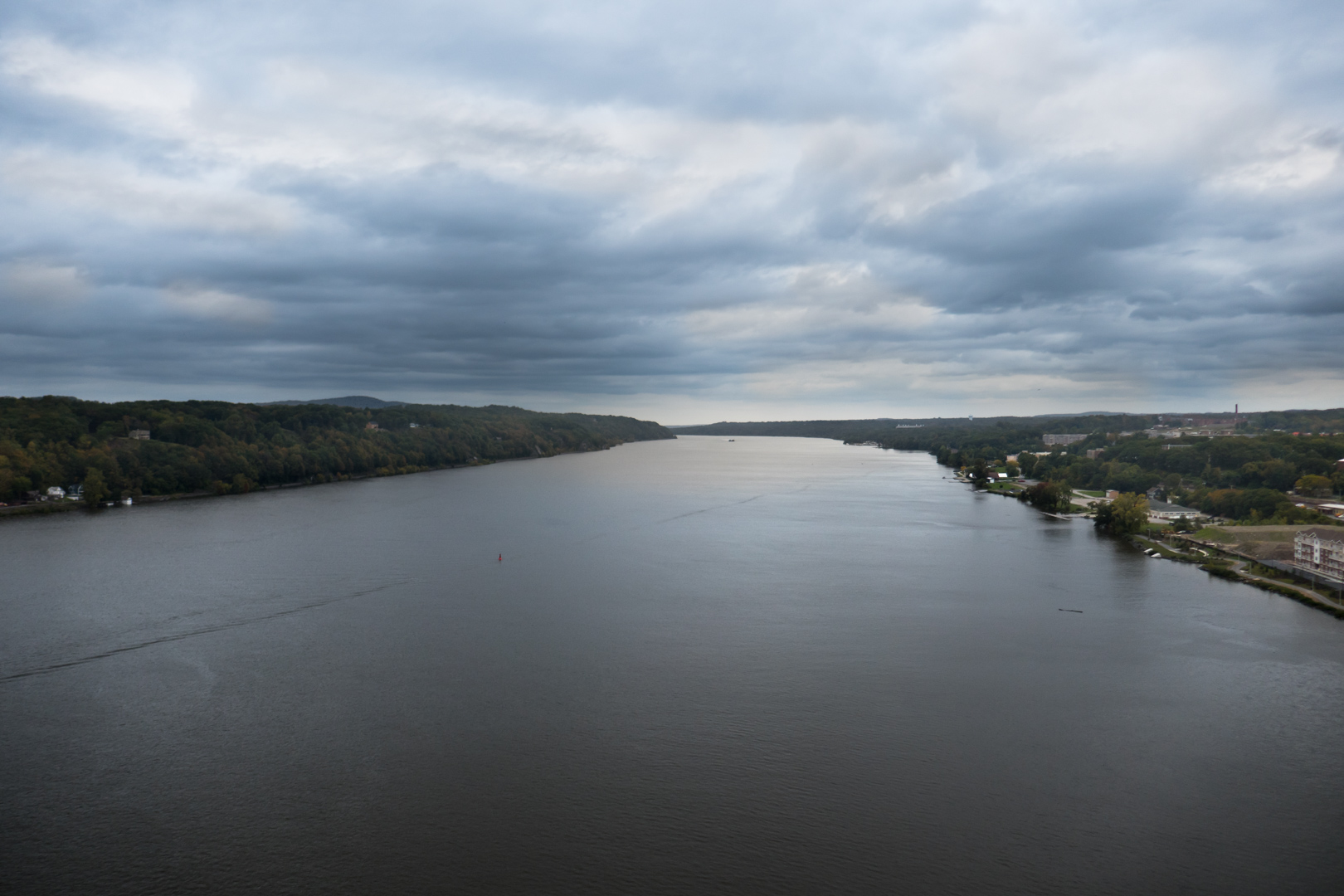
Even in the midst of all this natural wonder, however, it's hard not to focus on the gracefully lithe suspension bridge that sits just downriver. First opened in 1929, the rather aptly named Mid-Hudson Bridge was built to give cars and trucks their own route over the massive waterway at Poughkeepsie. But while this means that, in practical terms, it's essentially as long and as tall as the Walkway over the Hudson, in appearance, it feels like something from a different world. The hulking mass of girders that is the Poughkeepsie Railroad Bridge cannot help but trumpet its own domineering might: it's simply too massive to do otherwise. The sinuous, Art Deco lines of the Mid-Hudson Bridge, in contrast, seem almost delicate, as if the slender structure were made of nothing but air. Color further emphasizes the difference. While the rusting iron of the elder structure can meld into the earth tones of the landscape almost as if it were a natural feature, the light silver-grays of its younger sibling pop out from the boreal background with dramatic incongruence, emphasizing its metallic, artificial reality. Somewhere else, this entire scene—which seems tailor-made to emphasize how the "modern" roadway bridge has rendered the "old-fashioned" railroad crossing obsolete—might feel melancholy. Up here, however, floating at the same elevation as the Mid-Hudson's gothic-inspired arches, it's hard to be cynical. In truth, there is probably no bad angle to glimpse the elegant lines of a suspension bridge. That said, there are few better or more unique ways to take in this particular one than from the deck of the Walkway.


With all that noted—and appreciated—picturesque landscapes alone do not a public space make. Thankfully, though, the design of the Walkway over the Hudson helps to ensure that the bridge is not just an observation deck, but also a platform for public life. This is probably most easily seen in its ample seating. At regular intervals, the Walkway widens to accommodate rows of benches which flank the path on either side. Built of wood and concrete, and artfully inset with a simplified representation of the bridge itself, these do more than just provide a place to rest—even though that is undoubtedly an important job on a structure well over a mile long. They also serve as multipurpose urban furniture. Depending on who is using them and why, the benches can wind up serving a variety of roles, including being impromptu step stools for better views and pictures, ideal stages for the inevitable selfies, natural points for people to stop and have conversations, and more. What's more, these seating spots also help to break up and define the experience of the bridge itself. If it had been executed poorly, the long, corridor-like path of the Walkway could have easily wound up feeling amorphous and uncomfortable, like a space dedicated only to movement, good only for exercising and walking. Instead, however, these widened seating spots act like pearls on a long chain, creating comfortable nodes that simultaneously concentrate and amplify human activity in space.
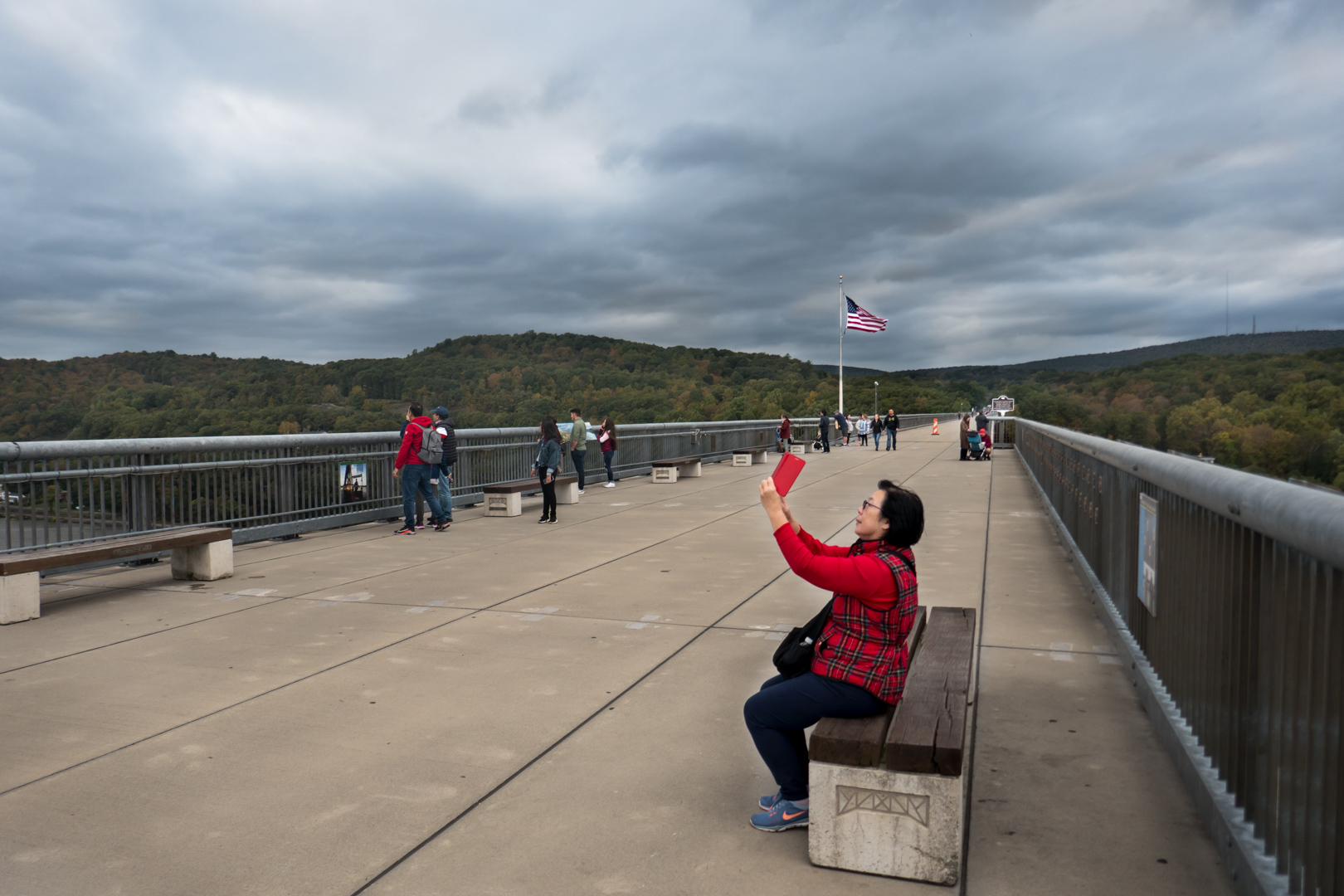 Nodes and benches along the Walkway.
The Walkway incorporates other public amenities, as well. One of its more notable features is a two hundred foot (60m) tall glass-walled elevator that connects the promenade to the riverfront below. At first blush, this can seem like little more than a tourist-centric extravagance. On closer examination, however, it actually serves an important public role: it creates a quick and easy pedestrian connection between the Walkway and Poughkeepsie's waterfront park below. This ties together two recreational spaces that, while physically close, would otherwise have been entirely separate and difficult to travel between without a car. It also gives more of the city’s urban neighborhoods easy access to the park.
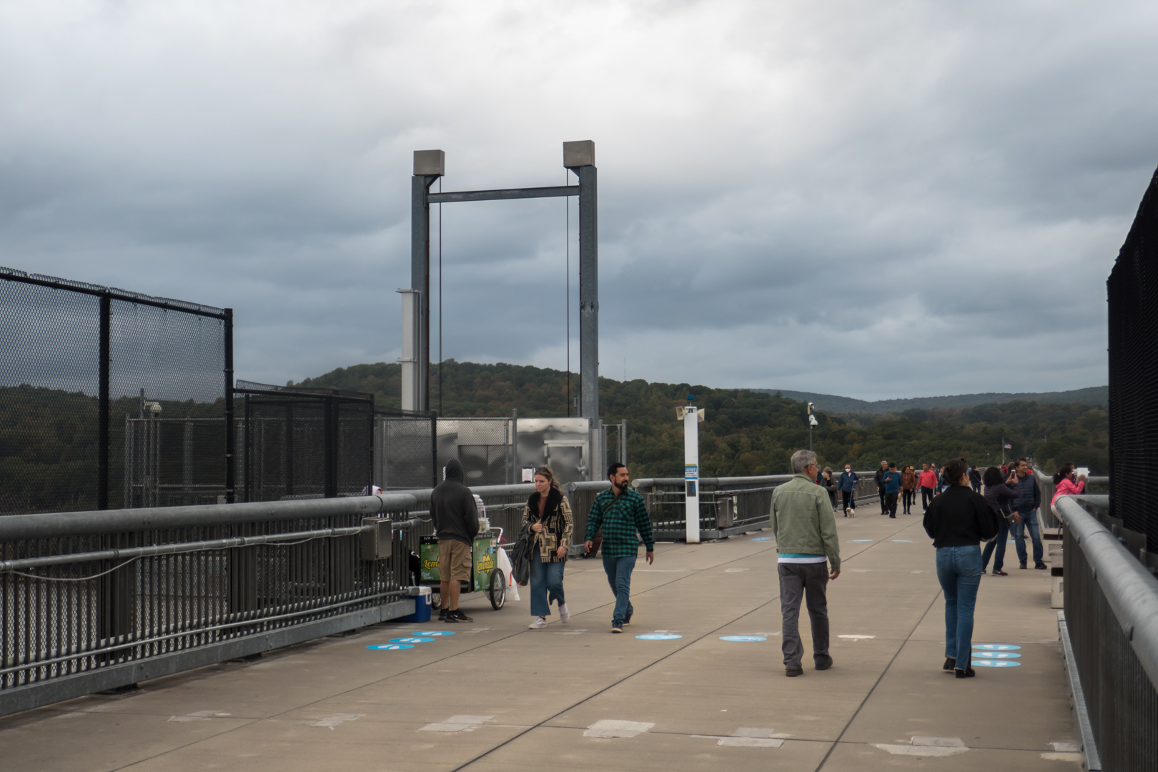

Continuing the Walkway's nodular design, this elevator joins the promenade at its own widened landing, where space has been reserved for a vendor's cart. This small touch achieves more than just a way to offer food and drink to those who might have forgotten to pack their own; it also works to shape the function of the Walkway as a space. First, it ensures that a set of friendly eyes are watching the path at all times, helping to assure that it remains a safe-feeling place even in the rare moments when pedestrian traffic might be sparse. Just as importantly, however, the vendor also simply gives another reason for people to be out here, and offers them more options for what to do while they are. This helps make the bridge feel and function far more like a full-fledged public space than just a long, narrow corridor that just so happens to have pretty views.
 The Walkway's nodular design.
A few other small touches round out the space. For those interested in the structure itself, there are a series of informative signs, historic photos, memorial plaques, and the like laid out at regular intervals along the path. These not only add another level of visual interest to an already dazzling ocular experience, but taken together, also offer surprisingly well-executed glimpses at the ecological systems of the Hudson Valley, the history of the town, and the story of the crossing itself. The park rangers who staff the Walkway seem to relish their role, and treat it with immense care. This has led to innumerable small touches, including the self-refilling water bowls laid out at strategic points along the route which help make the Walkway that much more of a comfortable space for its many canine visitors.
Even the far side of the bridge has something to offer. Given the western shore’s mountainous terrain and the Hudson’s wide expanse, it should come as no surprise that Poughkeepsie never extended to the opposite shore. The steep, rocky land here would have always been difficult to settle, and indeed, prior to the Walkway’s construction, it contained little besides forest, roads, and railroad tracks. The crossing, however, has gone out of its way to make its western terminus into an inviting spot. Here, there is a small visitors' center, restrooms, more picnic tables, and of course, the prerequisite parking for those visiting from points west. Like its eastern counterpart, this is a very functional and comfortable space, encouraging people to stop and spend time. Its nicest touch, however, has to be the retail space currently leased out to a local ice cream parlor. It's hard to imagine curating a better amenity for those in the middle of a long walk than a cold treat, especially during the warmer months.
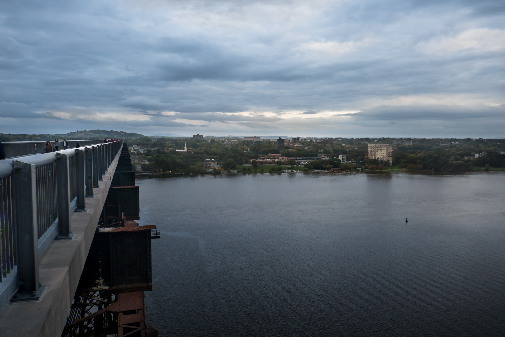 Looking back at Poughkeepsie.
At the western shore, with nowhere left to go, it's time to turn and head back to where we started, revealing the final vista that the Walkway has to offer. From here, the entire riverfront of Poughkeepsie comes into view in dramatic fashion, draped over the eastern hillside. If you're lucky enough to travel near dusk, every surface glitters with gold as the sun sets behind you. Along the shore, it's just possible to make out a constant stream of trains heading up and down the river, powering the small city just as they have done for the past 170 years. Today, most of these are commuter-oriented: Poughkeepsie sits at the far northern end of Metro-North's Hudson Line, and offers direct service to Manhattan's Grand Central Terminal. Long-distance intercity trains, however, are also still a regular sight, as Amtrak continues to provide service along the old New York Central routes to Albany, Buffalo, and even—as I was lucky to catch a glimpse of on this crossing—Chicago, via the overnight Lakeshore Limited. The vista is a perfect capstone for the Walkway: a dazzling image that also manages to connect present-day visitors to the enduring history of the bridge and of rail. That may be too saccharine a sentiment, but a space like this should be deliberately orchestrated to evoke romantic thoughts—and this one does so remarkably effectively.
A Different Steel Path
 Looking down on the tracks across the river.
On the topic of railroads, however, there is one final landmark on the far side of the crossing that deserves mention—especially in light of the Poughkeepsie Bridge's origins. Far down below the Walkway's western end, clinging to the base of the valley's cliffs, another set of rails travels along the river's far shore. While these tracks have long since ceased to carry passengers, they remain incredibly busy: every few minutes, it seems, a massive freight train rumbles by, making its way either up- or down-river. To carry so much traffic, the line must clearly be doing something right. For much of its history, however, this route was often considered something of a disappointment.
Like many Nineteenth Century railroads, the line was built by a succession of corporations that together make up a Byzantine list of shifting but nigh-indistinguishable names. Just like many of those same railroads, however, it was also ultimately known by a single, later, far simpler moniker: the West Shore Railroad. But while the line's nomenclatural origins might need a flow chart to fully understand, its purpose was always incredibly clear: the line was built in a brazen attempt to poach traffic from the far larger New York Central railroad on the opposite shore. It all but duplicated the larger company's Hudson River Railroad, traveling most of the length of the Hudson then turning west towards Buffalo. In fact, the only real differences between this line and its more famous sibling were that it began in the tangled railroad junctions of Jersey City instead of Manhattan, and, as its name implied, traveled along the opposite bank of the river.
The West Shore Railroad had barely begun running trains however, before—in true Nineteenth Century fashion—it was acquired by the very company with which it had been intended to compete. The New York Central simply had little interest in sharing its water level route out of the city and to the west—and there were persistent rumors that its arch nemesis, the Pennsylvania Railroad, might buy the line to increase the pain. But while the buyout may have been a boon for those who held West Shore debt, it was at least somewhat unfortunate for the future of the line itself. By and large, the New York Central had little interest in west-of-Hudson operations; the acquisition was simply a way for it to squelch competition. The company remained primarily focused on its original lines running along the eastern shore. As a result, for much of the next century, the West Shore Railroad was relegated to something of an auxiliary role, primarily serving local passengers and industry, as well as handling freight traffic heading into or out of New Jersey21.
Following the fire on the Poughkeepsie Bridge and the rise of the Selkirk hurdle, however, these tracks suddenly found themselves bestowed with new importance. All of the sudden, they now formed the primary freight conduit between New England, New York City, and much of the rest of the Eastern Seaboard. The timing was fortuitous. For one thing, thanks to a combination of containerization, industry mergers, and the restructuring of outdated regulations, freight revenue and freight traffic were on the rise for the first time in decades22. At the same time, the rise of Asian manufacturing meant that marine traffic—and especially marine container traffic—was skyrocketing. Happily for the West Shore Railroad, the line just so happened to provide the most direct connection between New England and the busiest port on the Eastern Seaboard, New Jersey's combined Port Newark-Elizabeth Marine Terminal. In fact, until 1985, Newark was the busiest container point in the entire country, and it remains the nation's second busiest to this day—not to mention the busiest on the East Coast23.
As a result, the line—now the River Subdivision of CSX—is busier than it ever has been before. The route is now a major link in the nigh-unfathomable flow of goods that connects the world, and from the Walkway, at least some of the scale of this massive, interconnected system is palpable. Over the course of a long stroll from one end to the other and back again, visitors are likely to see one or more mile-plus-long (1.6+km) freight trains plying their way up or down the river24, carrying a rainbow parade of containers, tankers, hoppers, boxcars, and more. These nigh-omnipresent trains vibrate with a constant low rumble that echoes across the entire valley, with a timpani-like percussion that creates an oddly fitting score for the breathtaking landscape. The inescapable presence of these trains is not only a reminder of the region’s industrial past, but a corporeal visualization of the enduring freight links that drive the global economy today. More provocatively, the trains also hint at the Poughkeepsie Bridge-shaped hole that still exists in the nation’s freight rail network. Perhaps the earlier management teams of Penn Central and Conrail were correct, and the elderly bridge simply had no future in an age of heavier, longer, less flexible freight trains. Had freight taken a different path, however—had the industry pushed harder to compete with the flexibility of truck traffic instead of retreating into ever-shrinking safe markets—it is easy to envision a world in which a link like the one in Poughkeepsie could have thrived.
The Deep Roots of Adaptive Reuse
That said, while the closure of the Poughkeepsie Railroad Bridge may arguably have been a loss for the transportation sector, its reopening as a piece of the public realm stands as a clear gain for the denizens of both Poughkeepsie and the wider Hudson Valley. The Walkway over the Hudson is a tremendous success, not just as a tourist attraction, but as a true public amenity. It may never actually rival the likes of the Eiffel Tower or the Golden Gate Bridge, but it doesn't have to: it's a tremendous space all on its own. And while it may not be able to revive the economy of downtown Poughkeepsie single-handedly, its presence—as a landmark, as a space, and as a symbol—give this small burg a sense of place far greater than cities many times its size. The Walkway's success doesn't just validate the dreams of those who toiled to make it a reality. It also stands as a testament to the strange power of adaptive reuse, even—or perhaps especially—on the largest of scales.
The practice of adaptive reuse, of course, is nothing new. In fact, although the name is relatively modern, the repurposing of old, existing structures for new uses is anything but—indeed, it may actually be one of the oldest and most fundamental of urban activities25. Traditionally, this has been a matter of money. Seen through an economic lens, buildings are physical concentrations of (often a great deal of) capital, resources, and effort. As a result, it only makes sense to recycle them—especially for projects or uses with limited budgets of their own.
That said, as long as there have been dense and crowded cities—places where space is at a premium and the constant change of urban life is a fact of existence—a clash between the urge to build anew and the urge to preserve what already exists has been all but inevitable. Both approaches are deeply rooted in the human psyche—they meet different needs for different people—and both reappear frequently throughout the history of city building. Perhaps then it's not surprising that both new construction and preservation also have strong arguments backing them, often made loudly by passionate partisans26. On one level, it is sometimes necessary and proper to raze and replace structures that are outdated, outmoded, and/or obsolete, making room for contemporary buildings that meet current needs and speak to modern ways of thought and modern ways of life. Cities cannot be static structures. If they are to survive and thrive, they need to be able to accommodate technological shifts, adapt to changing economic conditions, and find ways to serve new people and new populations. At the same time, however, buildings and the urban environments they create are more than just pieces of economic machinery or mere warehouses of people and things. They are also one of, if not the, most fundamental components of the human landscape. As such, they often play critical roles in how people use, understand, and appreciate space. As human creations, buildings and environments are not just a physical manifestation of expenditure. Observed through other dimensions, they equally embody historical, cultural, social, psychological, and even ecological values—and these are things that are not likely to be replicated by whatever new creations replace them.
This conflict between the urge to preserve and the urge to build anew tends to be most visible when the issue at hand is direct replacement: that is, old buildings torn down to make way for new structures. Discursively, this makes perfect sense: not only do such projects often entail difficult trade-offs, but they also tend to lend themselves to deeply emotive stories of good battling evil—for both sides of the discussion. The Poughkeepsie Bridge, however, faced a notably different situation. There were no replacement plans for the derelict crossing to worry about. In fact, given the general economic struggles of downtown Poughkeepsie, there were never even real plans for what to do with the narrow sliver of land that would be freed should it be demolished. Instead, the community was facing seemingly different issues: abandonment, decay, and limited resources. Simply put, how long could the structure stand before it became an intolerable danger to the residents of the city? Where would the money come from for maintenance or, failing that, for demolition? And less prosaically, was the obsolete, abandoned structure best seen as an ugly, menacing monstrosity, or was it instead an irreplaceable piece of the city’s heritage?
In this, Poughkeepsie's situation was far from unique. In actual fact, the clash between demolition and preservation is often the strongest in places that are struggling economically—places where resources are scarce, economic opportunities scarcer still, and where the symbolic shape of both the past and the future are still very much up for grabs. Conceptually, places like these are stuck in a sort of limbo, torn between a fundamentally irretrievable past on one side, and a host of conjectural futures on the other. This interpretive purgatory, however, plays out in a day-to-day reality that has a nasty way of forcing very corporeal decisions. In the moment, demolishing abandoned or underutilized structures can feel like the only justifiable course of action. After all, not only are they clearly failing to live up to their intended purpose, but—at least from this perspective—they are dangerous, expensive-to-maintain eyesores that are actively contributing to the city's struggles. Seen through that lens, they are, at best, something which should be relegated to the past, an unwelcome reminder of an era that has passed. And at worst, they are actual detritus that seems to stand in the way of any shot at economic regeneration.
This is the exact scenario that modern adaptive reuse was developed to deal with. At least under its current guise, adaptive reuse was largely born out of the US historic preservation movement—a cause that itself had come to the fore in no small part as a response to the demolition-happy excesses of urban development during the 1940s, 50s, and 60s. The dominant intellectual and political framework of those decades tended to view the traditional city as outdated at best, obsolete at worst, and in either case, in need of at least some amount of tabula rasa redevelopment in order to survive. By the 1960s, however, things had begun to change. An intellectual paradigm shift was afoot—and the rising preservation movement was playing a notable role. New thinkers and new activists were swinging the intellectual pendulum back as they developed a new recognition for the value of urbanity and urban function—and with it, often, an appreciation for older buildings and spaces, as well27.
Of course, the historic preservation movement was at its most visible (and most self-consciously heroic) in its battles to save renown buildings from destruction for modernist replacements. Consider for example, one of its most famous formative episodes, the efforts to save New York City's original Pennsylvania Station. Most of the time, however, the movement's primary obstacle was something far more prosaic than 'evil' redevelopment plans: money. Put simply, many of the buildings that advocates were trying to save were in poor physical condition, with very limited economic resources to draw upon in order to pay for repairs. In fact, many were deeply underutilized or outright abandoned—a result of the economic, political, and cultural push towards suburbanization. This was made worse by financial policies like redlining and the general reticence of banks to lend money for traditionally urban real estate projects, both of which ensured that capital for renovations remained hard to come by. Conceptually, it was comparatively straightforward—if far from easy—for preservationists to achieve their negative goal: creating legal frameworks that would prevent someone from overtly destroying a notable structure. On the ground, however, it was proving far more difficult to achieve the positive task of paying for the rehabilitations that effective preservation would require.
Over time, proponents would develop a number of workable strategies to find the cash they needed. Redirecting urban renewal funds to preservation, advocating for the creation of financial instruments like preservation tax credits, and pressuring financial institutions to lend money for urban renovations all played a major role—as did the rebranding of an old idea: adaptive reuse28. After all, if all it took was a small upfront investment to make a building economically productive again, preservation would suddenly become a much easier proposition. Some proponents took this logic even further. Most of the adaptive reuse projects of the era would be one-offs: individuals, small groups, or small institutions working one building at a time. If this work could prove that old structures had more than just intangible social and cultural value, however, but economic value as well, then perhaps adaptive reuse could be leveraged to catalyze urban growth on a larger scale. Perhaps it could even achieve what the first decade of urban renewal had largely failed to do—generate productive cities—only now through rehabilitation instead of reconstruction29.
Large-Scale Reuse: The Festival Marketplace Era
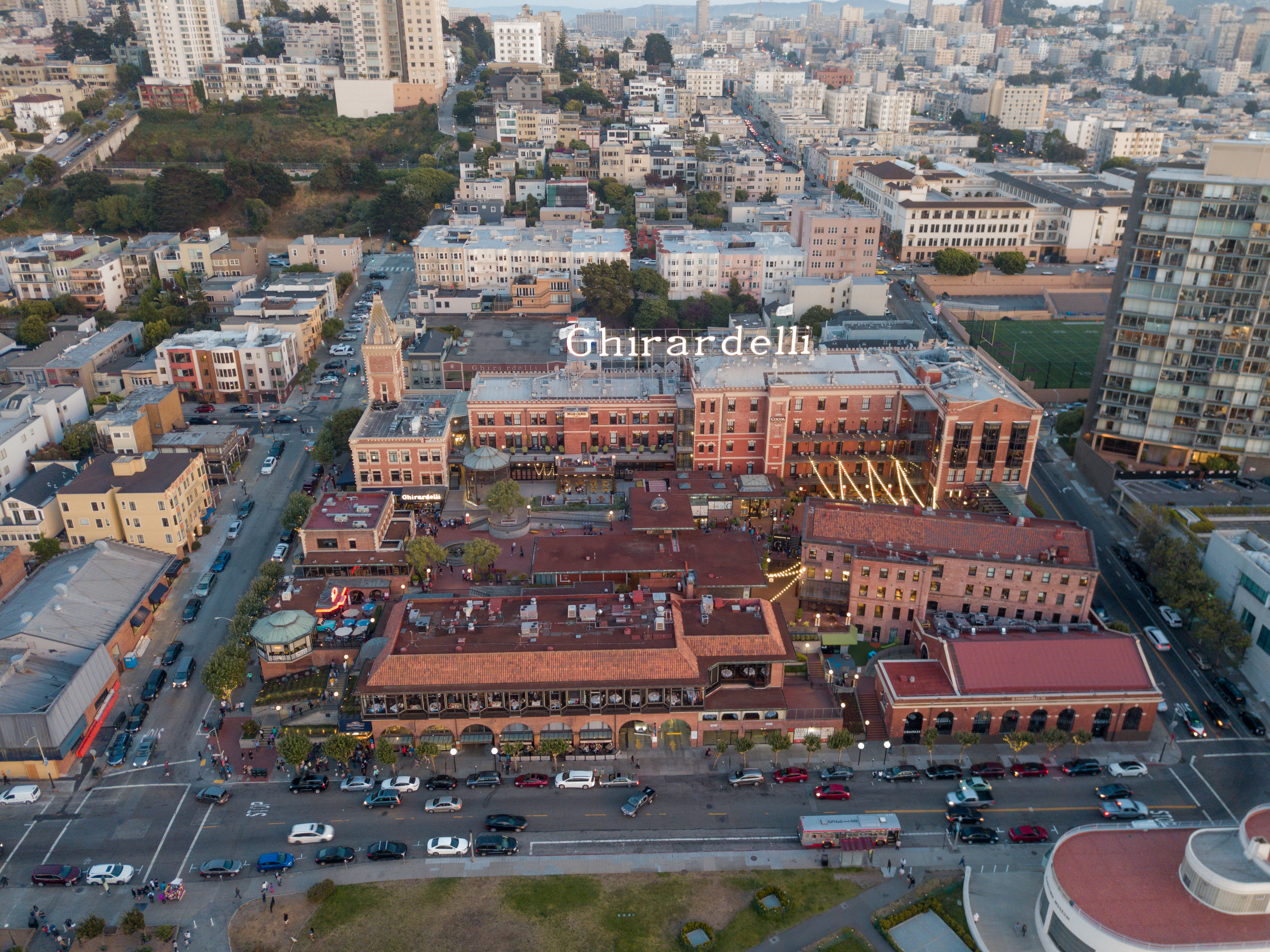 Ghiradelli Square seen from above in 2017.30
Consider, for example, the first major US project to call itself adaptive reuse, the 1964 creation of Ghiradelli Square in San Francisco, as well as the explosion of large-scale renovation projects it sparked. The Ghiradelli scheme centered around an old, outdated chocolate factory that had been slated for demolition and replacement. Local business executive and liberal activist William M. Roth, however, believed the complex’s buildings were not only an important part of the city's heritage, but also its urban texture. Determined to save them from the wrecking ball, he hired the notable landscape architect and US public space pioneer Lawrence Halprin to reimagine the structures on the site. Halprin, in turn, would come up with a plan to transform the buildings into a new kind of commercial development, one which would combine a shopping center, tourist destination, and privately-owned public space into one. In many ways, it would be an artificial all-in-one recreation of an ideal city, down to including its original buildings. At least at the time, the cocktail proved incredibly successful. Ghirardelli Square was designed to be a model, and its ideas spread quickly—especially thanks to the work of real estate developer James Rouse. Soon, similar so-called festival marketplaces—spaces like Faneuil Hall in Boston and the South Street Seaport in New York—began to appear in struggling downtowns across the country31.
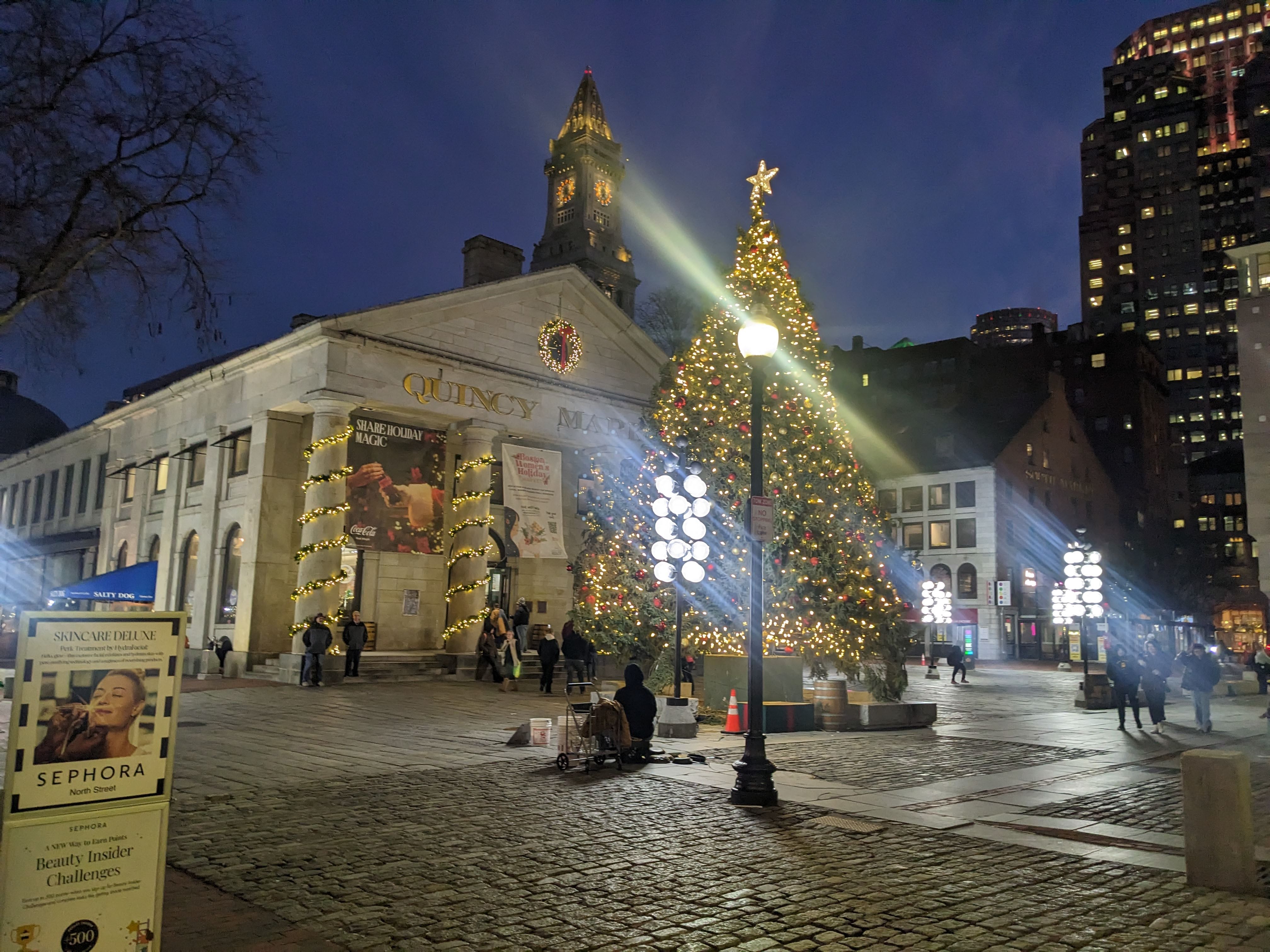

At first blush—and maybe even second or third, especially with the benefit of hindsight—the festival marketplace left much to be desired, especially as a model for urban redevelopment. Most were little more than suburban shopping malls built into renovated urban buildings, with a few other small attractions like pushcarts and museums sprinkled in to sweeten the mix. Sure, many tried to cultivate local stores early on, but the cost of the endeavor meant many would eventually retreat to higher-paying national chains as tenants33. On the one hand, this did mean that, at least early on, these spaces may have come closer to shopping mall inventor Victor Gruen's original conception of the mall as a multipurpose civic space—a replacement for downtown—than any of Gruen's own suburban creations ever did34. On the other, however, there was a perceptible artifice to these complexes, and not everyone felt welcome in their glitzy spaces35. Festival marketplaces wound up neatly encapsulating the urban thinking of their time: they primarily existed to lure white, middle- and upper-class suburbanites (and their shopping and entertainment dollars) back into the center cities that they had only recently fled. Unlike earlier urban renewal projects, however, they would attempt to offer something distinctly "urban" and "authentic," instead of simply something new. In an ironic twist, this led to an unforeseen consequence. Although these spaces were explicitly designed with local visitors in mind, they quickly became most popular with guests from much farther afield: tourists.
It is safe to say that the popularity and prominence of these largely lackluster developments helped fuel some of the skepticism of adaptive reuse that still burns strong in certain architecture and urbanism circles today. Like any urban tool, adaptive reuse is not a panacea, and when it's executed poorly—or when it's utilized for questionable purposes—it can easily create uncanny places that feel like little more than cloying, theme park versions of the past, gussied up to extract money from a new generation of consumers.
That said, however, festival marketplaces were also generally quite successful at what they set out to do. They pulled people (and their money) back into parts of cities that had been struggling, and in the process, injected at least a little bit of urban function and streetlife to places that had been moribund much of the day. In fact, at least on some level, festival marketplaces helped to reintroduce some of the pleasures of urbanity to a largely suburban audience—things like walking past storefronts, the bustle of public spaces, the freedom of simply spending in time in the public realm, and so on—even if that urbanity itself was often more than a bit contrived. What's more, and perhaps more importantly for the discussion at hand, festival marketplaces also helped demonstrate that, in certain circumstances, rehabilitating old buildings and old spaces could be just as effective at creating economic and urban growth as de novo construction—if not more so. Sure, it wasn't perfect urban growth—the projects were very much of their time—but the exact same could also be said for most of the clean-sheet redevelopment projects of the era, as well.
At this point, it's important to remember that, for all they did to simultaneously enhance and tarnish the reputation of the field, festival marketplaces were not particularly representative of most adaptive reuse—even if, for some, they are still the first thing that phrase brings to mind. The vast majority of building rehabilitation projects are not massive complexes with large-scale political support, significant sums of public money, and dreams of rehabilitating entire neighborhoods. Instead, most adaptive reuse is far smaller and more prosaic. Usually, buildings and spaces are renovated one-by-one, slowly recycling old or outmoded factories, warehouses, tenements, and the like into new housing, offices, schools, and retail spaces. And while the regulations that were created by the preservation movement like historic districts and tax credits have often played a role in this type of transformation, these projects are just as often driven by individual appreciations for existing structures and neighborhoods (plus, of course, a belief that the market will also share that valuation). In that sense, these renovation projects can often be seen as a kind of naive preservationism, one which is often quite different from the larger, more professionalized field.
In fact, even though adaptive reuse was born out of historic preservation, in many ways it has actually functioned as a third way between pure preservation on the one hand and the creative destruction of all-new construction on the other. Adaptive reuse allows urban space to dramatically change its function while retaining much of its original physical form. As a result, at its best, it offers cities a way to maintain some of their existing urban texture—and with it, hopefully, some of that texture's embodied historical, sociocultural, ecological, and spatial value—while also allowing those same cities to evolve and adapt to meet changing conditions, satisfy shifting needs, and serve new people. It obviously isn't always enough on its own—cities, especially fast-growing cities, need to change to survive and thrive—but it can be a very valuable tool, even when it's used for less-than-perfect purposes.
While the festival marketplace doesn't represent the vast majority of adaptive reuse, it does present a fascinating point of comparison for projects like the Walkway over the Hudson. Although both arise from very different eras and represent very different modes of urban development, both wind up exemplifying the epochs that created them.
Of course, in most of the ways that matter, the refurbished bridge has (thankfully) little in common with its government-sponsored forebearers. It is not nor was it ever intended to be a shopping mall. Indeed, it was never any sort of direct attempt at commercial development. Even though some of its proponents held larger dreams of economic revitalization, the focus of the project itself remained firmly on creating a piece of the public realm.
This public focus is a significant break from the festival marketplace tradition. Although these markets did center themselves around public places of a sort, critics often (rightly) pointed out that these privately-owned spaces were actually highly regulated and controlled, existing first and foremost as display places to attract shoppers. The Walkway, in contrast, was always meant to stand on its own as a place, and not just serve as set dressing for some other purpose. In doing so, it demonstrates that not all reuse need be chintzy or even commercial in nature, and in fact, can actually be put to use to create important pieces of public space infrastructure. While that certainly won't be a shocking revelation to many, the festival marketplace can often cast a long shadow over the concept of adaptive reuse as a whole—especially when significant amounts of government money are involved.
The overlap between the two types of development becomes clearer, however, in the Walkway's origins. While most adaptive reuse projects rise from the bottom up, as it were, festival marketplaces tended to continue the expansive, highly-orchestrated, top-down thinking that had typified urban renewal. At first blush, this seems a major change: the Walkway over the Hudson started more in the same idiom as most small-scale reuse projects. In its early years, at least, it was not seen as a massive redevelopment project, but rather simply as a way to preserve a local landmark and put it to new use. It was even begun by a small group who believed they could do much of the work themselves.
As the scale and demands of the Walkway became clear, however, the project began to take on a different tenor. With a newfound need to find a large amount of capital via both private philanthropy and state funding, the regenerative rhetoric that had always existed at the project's edges became louder, taking on a tone that rivaled some of the early festival marketplaces. Of course, a small non-profit fighting for the funds it needed to complete a massive undertaking was always going to result in some type of sales job. But even as the Walkway project remained internally focused on its original, comparatively straightforward intent, excited whispers comparing it to the likes of the Eiffel Tower became harder to ignore. A cynical outside observer could be forgiven for believing that the project had become little more than another development gimmick.
The most compelling connection between the refurbishment of the Poughkeepsie Bridge and the concept of the festival marketplace, however, comes not from them both being government-sponsored adaptive reuse programs or from sharing a soaring rhetoric of urban rebirth. Instead, it comes from the intellectual shift that the Walkway—and the other high-profile elevated parks like it—represent. Just as the festival marketplace wound up encapsulating the dominant strand of urban thinking of the late-1960s, 70s, and 80s, these modern projects equally reveal the prominent strains of urban thinking operating today.
To a significant degree, success in the modern urban economic landscape hinges on what is often called the experience economy. Thanks to the rise of internet retailing, various delivery services, and even the prevalence of inexpensive big box stores, most people no longer need to get their daily necessities from a physical shop—and if they do, those interactions are often limited to only one store. This change has obviously been disastrous for small retailers: it's simply difficult to compete with that level of convenience, product availability, and price, especially with the added overhead of urban rent. But while this shift has significantly eaten away at what had traditionally been the core economy of urban streetlife, in most places, it has also opened up a large niche for businesses that focus on what can't easily be replicated via delivery or bulk pricing: experiences. Whether these experiences are traditional, such as sitting in a restaurant, working in a cafe, or socializing in a bar, or more concocted, such as the highly orchestrated experience of a luxury boutique, a host of businesses have found success by offering more than just goods alone. Indeed, combined with the decline of traditional retail in most middle- and upscale neighborhoods, experience-oriented businesses have now become the dominant players in the urban streetfront economy36.
On one level, of course, this is nothing new, merely the apotheosis of a long-running phenomenon that goes back to at least the 19th century and the heyday of the Parisian flaneur. Urban life—at least, functional urban life—has long revolved around the experiences of people in space. What has changed, however, is the application of this experiential logic to the movement of people, jobs, and capital between cities as well. According to prominent urban thinkers like Richard Florida and his acolytes, right now, a certain class of highly productive urban workers often decides where they wish to live in much the same way as they decide where to visit—that is, not solely based on things like core economic factors, but also on the experiences and other less tangible benefits that a place has to offer. In that sort of environment, an asset like the refurbished Poughkeepsie Bridge can be seen as a major competitive advantage. After all, if places truly are in a long-term contest for denizens and dollars, then any city that can leverage its history—and especially its own prominent, inescapable psychic geography—should have a clear advantage over any number of other ostensible placeless places. In an odd way, this is essentially the same argument that was made by some of the Walkway's early, exuberant boosters—that it would put Poughkeepsie on the map à la San Francisco or Paris—only instead of just attracting visitors, the hope would be that the bridge would attract residents and their associated investments, as well37.
As was true of the desire to bring suburbanites to shopping centers downtown, there is undoubtedly a fair bit of truth to this argument—alongside a fair number of caveats and limitations. For one thing, barring the explosive success of certain projects like the High Line, the actual economic impact of this type of investment can be maddeningly difficult to quantify. Indeed, frustratingly similar arguments have been made for demonstrably poor economic investments, such as publicly-financed stadiums38. What's more, any economic scheme that focuses solely on attracting outside talent to the exclusion of generating the capacities of existing residents and businesses runs a real risk of being inequitable to the point of displacement. After all, while new residents can help a city pay for better services, will patronize local businesses, and generally speaking should always be welcome, these new benefits can't help the people who need them most if they are pushed out in the process.
Thankfully, the Walkway largely manages to avoid both of these issues for one main reason: its nature as public space. At its core, the Walkway is first and foremost a public amenity. This means its success is not predicated either on supporting a private, for-profit business or on the exclusion of wide swaths of the public—such as is true of stadiums or high-end shopping malls—but rather on how well it is used by urban denizens every day. As a result, quality public space like this is already a valuable and worthwhile investment even if it ends up generating little economic activity: anything it creates is merely a bonus. At the same time, not only is downtown Poughkeepsie clearly far enough down the economic ladder that it has room to grow before displacement becomes a pressing concern, but nothing about the Walkway's design is particularly exclusionary. This is especially true in contrast to the relatively opulent design of its High Line cousin—a high-end layout that left some disadvantaged locals feeling excluded—or to festival marketplaces, which often stressed consumption over everything else39. Thankfully, nothing about the Walkway over the Hudson is built for outsiders at the expense of existing residents: it happily supports both, and this is borne out by the people actually using it. Last but not least, a public space like this does not compete with existing local businesses the way, for instance, a state-sponsored shopping mall might. Instead, the Walkway over the Hudson enhances the entire shared public realm. Indeed, the project succeeds as well as it does precisely because it has found a way to serve so many varied types of people—both visitors and locals, both the privileged and the disadvantaged alike—while also simultaneously helping the city it calls home to grow and to thrive.
The Strange Public Power of Adaptive Reuse
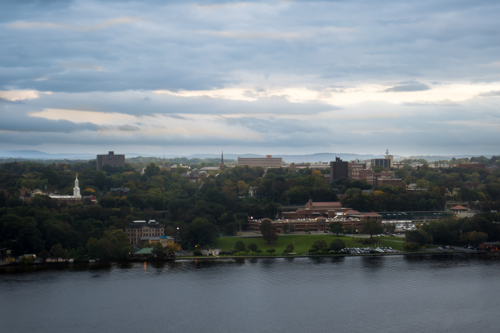 Downtown Poughkeepsie from the Walkway
With all that having been said, reducing the success of the Walkway over the Hudson down to its economic impact alone is more than a bit reductive. Indeed, the same could be said about adaptive reuse as a whole—no matter how much the movement has worked to sell itself on its financial logic. On the most basic level, to jump right to analyzing the economic impact of a place-based project is to put the cart before the horse. After all, for something like the Walkway to have a significant impact, it first has to work as an urban space, and attract people. If it fails at that, then its economic impact can only ever be negative, save perhaps for a few construction jobs.
More fundamentally however, it would be a fool's errand to try to separate adaptive reuse from the largely non-economic, preservationist logic that inspired it in the first place. There is a reason that, while most straightforwardly economic building renovations could accurately be described as adaptive reuse, they aren't the first thing that comes to mind when imagining the process. The phrase itself belies its preservationist roots, implying the reuse of something important—while also allowing the city to adapt. To understand the power and popularity of adaptive reuse requires diving at least a little into what makes preservation attractive in the first place. Because perhaps more than most other forms of preservation, when it is done well, adaptive reuse has an ability to tap into some of the basic ways that people experience, understand, and make sense of the urban worlds that they inhabit.
If I may beg the question for a moment, out of all the urban design strategies out there, what makes adaptive reuse so popular in the first place? To be clear, it isn't always universally admired, and there are plenty of examples that are hated or, worse, fizzle into nothing—not to mention plenty of newly constructed buildings and spaces that are beloved. Much like the individual structures that they renovate, each adaptive reuse project tends to be unique, specialized, and idiosyncratic in its own way. Still, when it works, adaptive reuse seems to strike a chord with a notably broad swath of the public. Even festival marketplaces, which were often viewed with skepticism by critics, found a broad (if somewhat short lived) appreciation from the general public.
Some of this obviously arises from fairly cynical fear of change—a force which should never be underestimated. People often have a fear of the unknown, and that fear is only amplified when it applies to something they hold dear, such as the city in which they live.
But there is as more at play, as well, as the renovation of the Poughkeepsie Bridge neatly demonstrates. Almost accidentally, the Walkway project found ways to tap into some of the most fundamental aspects of the human urban experience, with every part of the program serving to reinforce the ways people understand and appreciate urban space. Part of this is simply physical: it took a fundamental but originally off-limits part of the landscape and made it available to all. In doing so, however, it touched on many of the factors that drive people to create attachments to urban space in the first place. The Walkway demonstrates how adaptive reuse (when it's at its best) can take structures that are appreciated in some way, by some specific group of people, but are otherwise generally overlooked or undervalued, and transform them into genuine landmarks—places that serve as a touchstone for a far larger public.
At its core, urbanity is largely defined by the direct, physical and psychological experience of people in space40. There are, of course, many factors that define a thriving city, including things from density to productivity to the agglomeration of people, resources, activities, and uses. What really makes urban environments unique, however, is that they achieve these characteristics by prioritizing the experience of people in space. Urban spaces, in short, are human spaces. On the simplest level, this is purely functional. Urban environments need to be spaces where large numbers of people can live and work in close proximity, and humans tend to operate best in environments that match their physical proportions and meet their psychological needs. As a result, urban places tend to develop (or be developed, depending on one's point of view) with shapes that support these basic human requirements.
The centrality of the human experience to urbanity, however, necessarily brings with it deeper cultural and psychological implications, as well. For one thing, humans as a whole tend to be keen observers of our surroundings—whether we are fully conscious of the process or not—and we use the information we glean to generate sophisticated understandings of our environs. These perceptions can range from something as straightforward as our own internal mental maps of space all the way up to complex and sweeping narratives of society, culture, and belonging41. To simplify a complex process, we tend to create meaning out of the spaces we inhabit, applying our own understandings to what we see and perceive around us—and in turn, these meanings shape how we utilize, experience, and understand both these spaces and others moving forwards.
This obviously happens in different ways and to different degrees for different people, depending on things like temperament, background, education, and more. One particularly common form, however, is a strong appreciation for structures that create connections with the history of a place. This is most obvious with notable historical buildings, of course, but it needn't be limited to such a grand scale. In fact, people often develop surprisingly strong affective ties to the quotidian: the old building or the abandoned piece of infrastructure that spur thoughts of what a place must have been like in the past, or reflections on how the story of most urban spaces spans more than that of a single human lifetime. In part, these connections are about survivorship in a deeply impermanent world. There is comfort in knowing that something which preceded your birth will continue to exist long after you are gone. At the same time, they are also related to the way we utilize physical landmarks to create our own images of a city—and how we often wish for those images to be permanent, and for our reference points to endure. In many ways, a physical space and our comprehension of it are oddly reciprocal: we not only forge complex understandings about our environment from what we find within it, but our beliefs about that environment in turn inform how we identify and define landmarks going forward.
Now obviously, this should not be taken to mean that everything in a city can or should be protected. Like with many things, when this affective impulse is taken too far (or too literally), it can easily become a vice. But whether it’s a conscious process or not, people often imbue deep meaning into these tiny bits of quasi-permanence. These actual meanings themselves, of course, will vary dramatically depending on the proclivities of whoever is doing the observing—such is the nature of urban diversity. But as with all things pop history, the connection will tend to be strongest with things that people believe speak to their present, to how they got to where they are now, and/or to where they believe they are going in the future. The early twenty-first century is far enough from the era of industrial decline for the most painful scars to have faded, but close enough to allow for rose-tinted romanticism. In that regard, as a popular artifact, the Poughkeepsie Bridge seems almost perfectly tailored to the present moment, especially when new futures seem clearer than ever.
Historicism isn't the only affective human force that adaptive reuse taps into, however. As a general rule, humans tend to seek out a sense of identity or belonging, at least to some degree, in one form or another, and we often find it in what can seem like the most mundane of things—for example, the information we glean from our everyday environments. For better and for worse, we often take the basic physical facts of our world and incorporate them into our self-conceptions, seamlessly weaving them into the narratives we create about our lives. In the process, we often wind up exercising a kind of non-exclusive, psychological ownership over the spaces we inhabit and the landmarks that define them.
This is probably most obviously seen in the relationship between a city's residents and their skyline. While the buildings and structures that make up a skyline are almost always privately owned—and indeed, while most people will never even have the chance to step inside most of them—their inescapable omnipresence naturally leads people to strongly incorporate them into both their sense of place and their sense of self. This is one reason people may grouse about new buildings—especially those that take the height mantles of what had been their favorites—but then, after a few years (and many new memories), come to appreciate them as they begin to incorporate those same new buildings into their mental frameworks as well. Something similar can happen in reverse, too. While the loss of tall structures is (happily) rare, if they were dominant—as was true of, say, the World Trade Center—the scars of loss can take decades to truly heal. This collective sense of (non-exclusive) ownership was clearly visible with the Poughkeepsie Bridge. Visually inescapable, it became a symbol of the city almost as soon as it had opened, and its presence has remained so powerful that it would later inspire other locals to fight to save it from destruction—even when it had long ceased being useful at its original role.
Put together, it becomes clear that the Walkway over the Hudson resonates so deeply with people precisely because it has been able to capitalize on these deeply-rooted facets of the human urban experience—both how we understand urban space and take psychological ownership of it. On a conceptual level, the project had a simple enough goal: to save an endangered landmark from destruction. As those pushing the Walkway knew, however, this was not just any landmark: it was one which was prominent, inescapable, and which spoke directly to Poughkeepsie's history and identity. In that regard, it might as well have been tailor-made to trigger deeply emotive reactions, appeal directly to people's self-conceptions, and reinforce their attachements to and understandings of their own environment.
The project didn’t simply stop there, however. The Walkway over the Hudson took this landmark foundation and built upon it in ways that only deepened its public significance and utility. Unlike far too many efforts at historic preservation, it didn't just stop at freezing the bridge in amber and leaving it as it was. Instead, it took a structure that had been public only in so much as it existed in the collective public experience and refashioned it into a true public space—and a true public amenity. Today, the Poughkeepsie Bridge is no longer just a background element in the daily life of the city. It is now a publicly-owned, easily accessible, public place that people can experience and utilize in their own lives as they never could before.
In other words, the Walkway was not only able to harness the public's diffuse, psychosocial ownership of its own skyline and history—a type of highly contentious shared ownership that can often be downright stifling or exclusionary when taken too far—but gave those powerfully affective feelings a depth of public purpose that they never before possessed. Put simply, the project took much of the symbolic and romantic energy that drives historic preservation and found a way to put it to deeper, more functional, more public uses. In a real way, it took a mark on the land and made it into a landmark.
This is adaptive reuse at its best. The Walkway over the Hudson took something that was symbolically resonant, had historical value, but was no longer useful at what it was designed to do, and gave it a new life—one that is highly relevant to the Poughkeepsie of today. As a result, while the Walkway does share some characteristics with the festival marketplaces and other large-scale urban revitalization projects of old, the results are notably different—something cities looking to copy its magic should recognize. The Walkway is a public space first and foremost. It’s not a simulacrum of urbanity designed to give suburban shoppers a cosmopolitan vibe, but a space that is open and welcoming to all, giving space for many different types of people and activities. While some of its boosters did hope it would lead to new economic activity, the Walkway was never directly designed to encourage consumer spending. Instead, the project created a focused amenity for the region that, through success at its primary, public purpose, will hopefully have positive spillover effects—both economic and social. It is not a shopping mall that receives a generous subsidy to compete with the urban streetscape, but instead an everyday extension of the urban realm. Tourism may have always been a goal, but the Walkway was deliberately built to be useful for urbanites, regional residents, and visitors alike—something festival marketplaces often failed to achieve. Even its perspective on history feels less chintzy than some of the worst-offending festival marketplaces. The Walkway doesn't revel in some idealized version of the past, but instead simply puts a (locally-)notable historic artifact to new use, while paying generous homage to what came before. And while it wound up being an expensive project, to be sure, that money was spent directly on preservation and public space, and not on the promotion of specific private enterprises, as might be the case with a marketplace (or, worse, stadium).
As a whole the Walkway over the Hudson is an affirmation of the public realm. Practically speaking, it is free, open to all, and suitable for many different uses. And symbolically, it speaks directly to Poughkeepsie's public identity and shared public history. It not only resonates with people's own experiences and their understandings of the spaces that they inhabit, but has done so by making the city it inhabits more open, transforming a once-private piece of the public skyline into a truly open space—all while celebrating a remarkable and inescapable part of the city's history. It is not only a powerful example not only of adaptive reuse done right, but also of how well-executed adaptive reuse can be used to strengthen all aspects of the public realm—not just physically, but intellectually and symbolically as well.
Inevitable Imitators
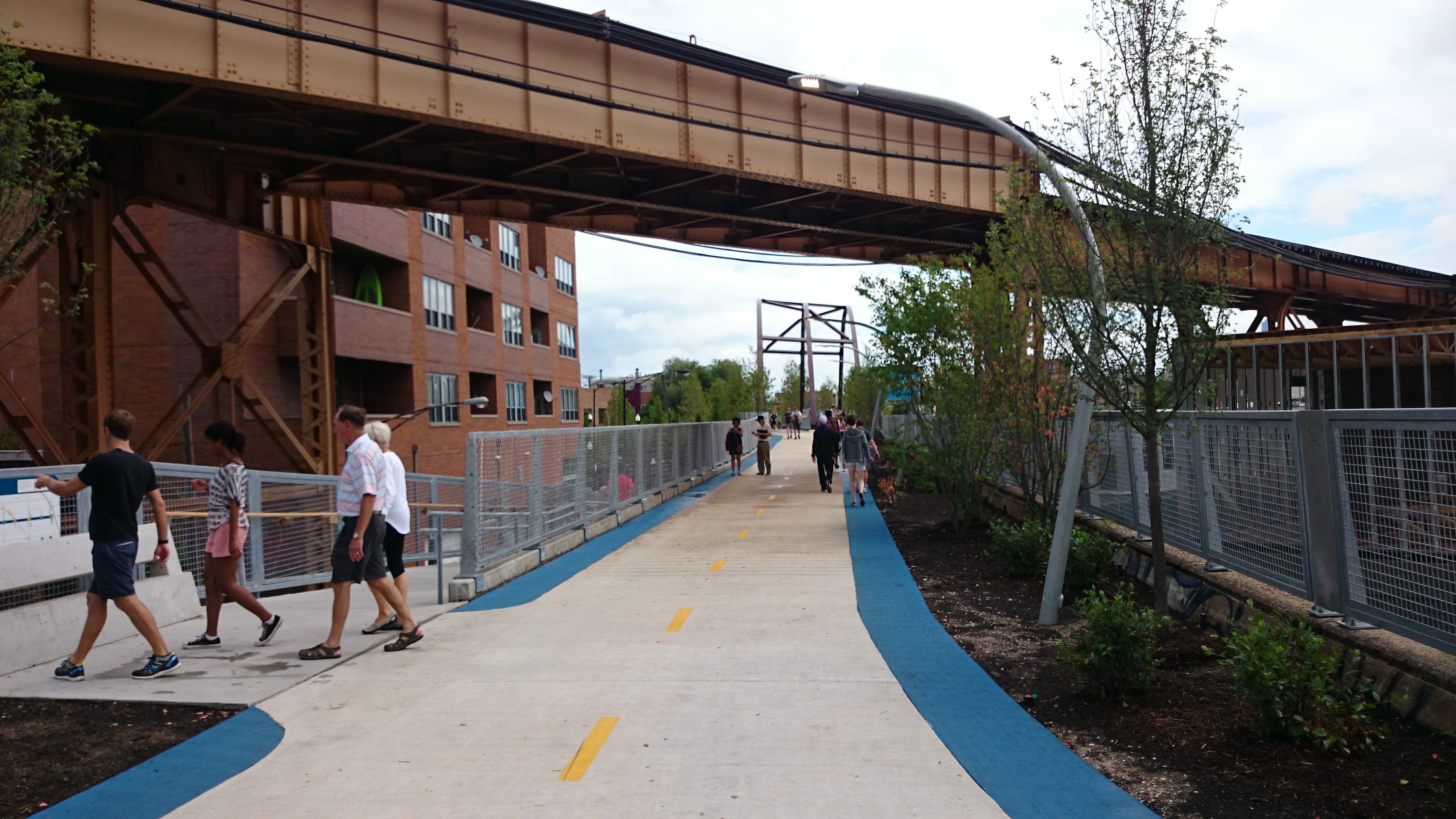 Chicago’s Bloomingdale Trail / The 60642.
The success of the Walkway over the Hudson—and especially the success of its sibling project, New York City's High Line—has not gone unnoticed, of course. For better and for worse, it now seems like every city and town across the country believes that repurposing some derelict piece of infrastructure of their own will be the key to their urban future. Much as Ghirardelli Square served as the template for two decades of festival marketplaces, the Walkway and High Line together have pioneered a new movement focusing on elevated parks as the cornerstone for urban vivification. And while it is gratifying to see urban public space having a moment, a cynical observer would be forgiven for coming to the conclusion that dramatic parks built on derelict infrastructure have simply become the urban objet d’art of the present moment—something every city feels like it needs.
The sad reality, however, is that most of these Walkway and High Line clones will probably fail to live up to their boosters' lofty expectations. As Jane Jacobs first noted more than sixty years ago, parks are not a universal solution for every urban ill. In fact, poorly located green spaces can actually become dead zones that inhibit urban life43. And while these parks probably won’t be that disastrous, in most cities, suitably abandoned infrastructure is simply situated in the wrong place for this type of conversion: it’s either isolated in industrial neighborhoods or quarantined away in awkward borderlands that connect nothing with nothing. Of course, as the Walkway itself shows, location isn't everything: a suitably spectacular space can act as a people magnet all on its own, pulling denizens out of their private confines and into the public realm. These types of spaces however, are by their very nature rare and hard to pull off. Parks and public spaces cannot be thought of merely as art objects: to be useful, they must meet urban needs and support urban function. This is one reason that even though American cities suffer from a deficit of high-quality public space, they almost certainly have more underutilized urban parks than overutilized ones.
Complicating matters further, even if these new park projects do succeed to the level that their boosters hope, they will still face significant challenges—challenges that differ dramatically depending on where they are located. In so-called superstar cities, places which already have stratospheric housing demand, such parks risk being labeled as green gentrification. Of course, one of the primary drivers of dramatic neighborhood change and population displacement is a regional lack of housing to meet soaring demand—something which theoretically should have no impact on the decision of whether or not to build a park. At the same time however, sparkling new public spaces can focus high-end development like a laser beam—and if the goal is to attract new residents at the expense of existing ones, the charge can hold merit. Conversely, for the vast majority of American cities, the regional demand simply isn't there to encourage new urban development—at least, not to the degree generally required to convert formerly industrial neighborhoods into vibrant urban ones. As a result, these parks either risk being stranded in the middle of nowhere, or their cities risk spreading the urban investment they can muster overly thin, leading to only partly functional urban neighborhoods, at best (for an example, see the Indianapolis Canal44).
Most fundamentally, however, I simply find it hard to be optimistic about the gold rush mentality surrounding the elevated park trend. Development fads don't tend to breed realistic thinking, adequate planning and design, or achievable expectations. Instead, they tend to become a race to the lowest common denominator, an attempt to cash in on a phenomenon that their promoters barely understand before the trend peters out. As a result, I fear that most of the fine details that make the Walkway so special—its obvious passion for the region's history, its clear understanding of what will resonate with the community and the region, and even its effective use of the basic elements of public space—will simply be absent at these new creations.
Perhaps that pessimism is misplaced, however. Unlike so many of the fads that have preceded them, the elevated park is not simply another top-down project monomaniacally focused on an (often) dubious strategy for economic growth. In fact, for all their warts, these projects are not solely development strategies at all, but also real pushes for real public spaces. Now of course, when executed poorly, or without any understanding of urban function, public space investments can fail spectacularly—something to which almost any relatively large American city can attest. Happily however, urban design is no longer stuck in the 1960s and 70s, and more often than not, new urban parks tend to rise to at least an acceptable level of quality, if not better. They may not be perfect, but even the most disappointing usually become something a city can iterate on and build off of if they are so inclined. Given the aforementioned deficit of quality public places in US cities, even imperfect parts of the public realm can have real value. If these projects can create places that are at least decent enough—something that cities can continue to refine and reinvent—then perhaps it's counterproductive to be cynical.
That said, if this fad is going to continue, then the proponents and designers of these new parks need to be careful what lessons they take from the Walkway over the Hudson and its ilk. Like most deeply impactful urban projects, the Walkway is more than a bit sui generis. There is no magic formula for creating transformative urban space, no ready-made, paint-by-numbers approach that can be plopped down anywhere and be guaranteed to achieve miraculous effects. (If there were, the history of cities would be a lot more straightforward.) That said, there's no reason to be obscurantist about urban design, either. The field has—over long, hard, bitterly contested decades of refinement—developed a number of basic rules and best practices for creating deeply functional urban spaces. When these are deployed skillfully and in the right places, they are usually tremendously effective45.
In this regard, the Walkway over the Hudson is as fine an example to study as any other, especially for what it is. This does not mean, however, that an enthralled city should slavishly copy the entire concept. While the Walkway has many little affordances and design decisions that are worth learning from, the main thing it teaches should be that there is no shortcut for actually learning and applying the basic principles of public space—nor to actually studying the local context to discover where and how best to apply them. It's mighty tempting for an overeager booster (or an urban charlatan peddling instant change, for that matter) to want to run with the simplistic idea that, 'elevated parks are magic, and we/you need one, too!' However, while a poorly thought-through elevated park may potentially turn into a functional or important public place, there is no reason to turn the development of such important infrastructure into a crapshoot just to follow a fad. Unique and desirable public spaces that actually meet the needs of many different types of people will always be in demand. Build and operate them thoughtfully, and they become one of the most valuable investments that a city can make, both socially and economically. It is more than worth the time and effort to make sure they are done right.
Sadly, for many cities and towns, this first takeaway is already proving hard enough to internalize: between the money and the hubris involved, much of city building is still a field that doesn't take well to subtlety. And yet, the Walkway over the Hudson's second major lesson is something even more delicate to understand, let alone implement. Simply put, when it comes to creating public space, there is often more to consider, utilize, and employ than just the design and use of the physical space itself. Yes, the Walkway is a high-quality space with spectacular views. In many ways, however, it’s also more than simply the sum of its parts. It aimed for goals larger than those of most public spaces, and it succeeded at them: it preserved an important part of local history, it created something that directly speaks to regional identity, and it made accessible a landmark that for nearly 140 years has been a point of local pride.
The completed Walkway over the Hudson is such a special place because it has found ways to tap into some of the deeply public, deeply urban, and often deeply romantic facets of the human relationship with cities that most urban projects—even most very good urban projects—do not. Applying this methodology in another city may very well result in a space that, on the surface at least, looks quite different from an elevated park. The overall physical shape is far less important than finding, amongst all the structures and spaces a city has to hand, the things that can spark the public imagination the most, and then putting them to good use. The Walkway over the Hudson demonstrates the depth that can come from constructing public spaces that understand the term “public realm” in its broadest possible sense. It exemplifies the power that can arise when public space interfaces with other, less tangible concepts like public history, public self-conception, and the public's image of the city. By doing so, it has forged something even more valuable than just a deeply functional public space alone: a place that also helps to define and reinforce a city and its constituent communities—all without being exclusionary.
Practical Romanticism
 The Walkway over the Hudson from the Mid-Hudson Bridge
When it’s executed well, adaptive reuse can exert a strange and wonderful power, one which exerts its influence across a surprisingly broad audience. It captures much of the magnetism that draws people towards historic preservation—which, of course, makes sense, given their shared origins and overall similarities—while managing to avoid some of pure preservation's potential pitfalls. Of course, much can and has been said about the preservation movement as a whole, both positive and negative. For all its familial resemblance, however, adaptive reuse is very much its own tool, one which represents a third way between pure replacement on the one hand and locking structures away under glass on the other. Sure, it isn't always appropriate—or enough. But done well, it not only allows cities to balance the urge to preserve and the urge to build anew. It can also be used to enhance people’s experience of the urban realm, while also reinforcing their connection to it.
This is especially true—as the Walkway over the Hudson shows—when adaptive reuse is used to create meaningful public space. Through just one single project, a city can at once preserve something it finds socially, culturally, or historically valuable, while also opening that same piece of heritage up to the public in a way it almost certainly was not before. It allows places to realize much of the emotional power of preservation while also creating something with far clearer value for all. When it’s at its best, adaptive reuse can be a kind of practical romanticism, a way to craft public places that resonate deeply in peoples' psyches precisely because they are deeply rooted in the broad public realm. These projects do more than just bring with them a built-in audience—although that shouldn’t be ignored. They also have a resonant power precisely because they reinforce some of the key ways that people experience and understand urban space.
These types of projects may even bring economic benefits as well, although unlike earlier large-scale adaptive reuse projects like festival marketplaces, that needn’t be the function of public space. In many ways, the elevated park trend is a poor comparison to the festival marketplace. And yet these parks do bear at least one important similarity with their Ghirardelli-inspired predecessors. Much as the festival marketplace encapsulated an urban belief structure that thought the key to survival was to lure suburban shoppers back downtown, the elevated park exemplifies the present urban preoccupation with competing in the experience (and attention) economies.
So will the Walkway over the Hudson fix all of downtown Poughkeepsie's issues? Probably not, but that was always too much to ask of it, anyway. It most certainly won't hurt, and in a strange way, it will probably help the city more now than it ever did when it was a through-running piece of freight infrastructure. While the bridge may have been grand, the fact that most of the trains traversing it never stopped in Poughkeepsie meant that its visual symbolism was always more potent than its on-the-ground practicality, at least locally speaking. Beyond that, dissertations could be written on the potential deeper meanings of a former piece of industrial transportation infrastructure being transformed into recreational and social space, and what that might say about the place and role of the American city in the twenty-first century. Is this transformation of urban reality a result of the long process of cities exporting their productive but space-hungry industries46? Is it a result of economic policies that have offshored jobs, or perhaps the result of the long march of automation? Does it highlight something valuable about the shift from an industrial economy to a service-based one, or is that framing not adequately descriptive? And isn’t this all far too much to project onto one comparatively simple project? In a different world, perhaps the bridge could have still played a major role in our present-day transportation network, much as both of the rail lines that run far beneath it still do today. This line of thinking, however, is a good sign. When projects engage deeply with meaning of a particular city, they tend to bring up existential questions like these—and it’s a wonderful thing to behold.
Whatever it may have achieved as industrial infrastructure in a different world, however, the Walkway over the Hudson of today has given Poughkeepsie something that many small cities like it lack: a deep sense of place. It will not be an easy feat to copy—although God knows many will try. At the same time however, it’s easy to see why it inspires imitators in the first place. As a piece of urban infrastructure, it’s a far cry from the festival marketplace and its often ersatz public realm. And as a piece of adaptive reuse, it’s a testament to the effectiveness of a technique that all too often only gets lip service from both preservationists and development boosters alike. The Walkway is an outstanding achievement, one which actually manages to live up to the gargantuan scale upon which it was built.
- 1. Mutual of Omaha's Wild Kingdom, "Wild Kingdom – The Wild Animal Sanctuary – Walkway." (Video, March 19, 2018, https://ghostarchive.org/varchive/oOf_34xI-YE).
- 2. Detroit Photographic Company, "Poughkeepsie Bridge. (Poughkeepsie, New York.)" (circa 1897-1924, https://commons.wikimedia.org/wiki/File:Detroit_Photographic_Company_(0676).jpg).
- 3. Brian J. Cudahy, "Rails Under the Mighty Hudson: The Story of the Hudson Tubes, the Pennsy Tunnels, and Manhattan Transfer" (New York: Fordham University Press, 2002), 28, 30.
- 4. J.W. Swanberg, "Railroad Blueprint: Maybrook, New York," Trains (January 2005, Vol 65 Iss 1, 50-59).
- 5. Roberto Cruz, "Railroad bridge fire 40th anniversary: Fire in the sky," Poughkeepsie Journal (May 7, 2014 https://www.poughkeepsiejournal.com/story/news/local/2014/05/07/poughkeepsie-railroad-fire-anniversary/8831573/).
- 6. ibid.
- 7. "Bridge Help Refused" The Evening News (Newburgh, NY, May 22, 1976, p. 3A).
- 8. Uday Schultz, "Planning, Freight, and the Creation of the Northeast Corridor," Home Signal (August 16, 2022, https://homesignalblog.wordpress.com/2022/08/16/planning-freight-and-the-creation-of-the-northeast-corridor/).
- 9. Morgan D. Wright, "Poughkeepsie, NY, railroad bridge, in 1981," (June 1981, https://en.wikipedia.org/wiki/File:PoughRRbridge2.jpg).
- 10. Hudson River Valley Institute, "Donald Pevsner: Worked on Bridge Preservation" Walkway Over the Hudson Oral Histories (January 27, 2009 https://www.hudsonrivervalley.org/documents/401021/1299759/pevsnerdonald.pdf/9fbf7a88-4c02-47ef-b112-fe8c140eb225).
- 11. Mary Forsell, "Walkway Over the Hudson: A History," Hudson Valley (September 10, 2009).
Walkway over the Hudson, "Facts about the Walkway over the Hudson," (http://walkway.org/about-us/our-story/, Accessed May 2024). - 12. Associated Press, "Hudson rail bridge to be high-altitude walkway," (October 26, 2008).
- 13. This includes both the City and the Town of Poughkeepsie, which border one another.
- 14. Forsell 2009.
- 15. Forsell 2009.
Micheal Valkys, "Financing a dream," The Poughkeepsie Journal (September 20, 2009).
Greg Marano, "Railroad bridge project costs rise," The Poughkeepsie Journal (July 8, 2008).
Dyson Foundation, "About" (Accessed May 2024, http://dysonfoundation.org/about/). - 16. Emily Stewart, "New walkway exceeds expectations, as folks flock to bridge," Poughkeepsie Journal (Dec 29, 2009).
- 17. Valkys 2009.
- 18. You can see this attitude in Fred Schaeffer's comments in Forsell 2009.
- 19. While this section was written before I was aware of its existence, it would be remiss not to mention the wonderful Chapter 4 of Why Public Space Matters, which undertakes an engaging analysis of the bridge, as well.
Setha Low, "Rebuilding a Bridge and a Community: Health and Resilience at Walkway Over the Hudson, Poughkeepsie, New York" in Why Public Space Matters (New York: Oxford University Press, 2023), 63-84. - 20. Asher Brown Durand, The Catskills (Painting, 1858).
- 21. Charles L. Ballard, "The West Shore: A Brief History and My Experiences," ed. Steve Sconfienza, Ph.D., New York Central Historical Information (1998, https://web.archive.org/web/20060717080407/http://www.crisny.org/not-for-profit/railroad/nyc_hist.htm#westshore).
- 22. John F. Stover, "The Staggers Rail Act of 1980 Brings Prosperity and Many Mergers," in American Railroads (Chicago: University of Chicago Press, Second Edition, 1997), 245-62.
- 23. Eric Lipton, "New York Port Hums Again, With Asian Trade," The New York Times (November 22, 2004).
- 24. The average length of CSX freight trains is already over 7,500 feet (2,300m), and examining the tracks on satellite imagery, the passing sidings on the River Subdivision are more than long enough to accommodate these trains.
Bill Stephens, "Railroads' use of long distance trains to go under the microscope," Trains (November 15, 2021, https://www.trains.com/trn/news-reviews/news-wire/railroads-use-of-long-trains-to-go-under-the-microscope/). - 25. "The need for aged buildings" in Jane Jacobs, The Death and Life of Great American Cities. (New York: Vintage Books, 1961), 187-199.
- 26. Antecedents are everywhere, but for a Nineteenth Century example, compare the work of Ebenezer Howard—who advocated for entirely new garden cities—and Patrick Geddes, who advocated a minimally invasive, surgical approach to existing places.
Ebenezer Howard, Garden Cities of To-morrow (Classic Books International, 1898, 2010),
Helen Meller, Patrick Geddes: Social Evolutionist and City Planner (New York: Routledge, 1990).
Conversely, in the present day, see the debate that can sometimes arise between the YIMBY movement and movements for historic preservation, eg Anbinder 2022 vs Meeks 2016:
Jacob Anbinder, "What Historic Preservation Is Doing to American Cities," The Atlantic (May 2, 2022 https://www.theatlantic.com/ideas/archive/2022/05/historic-preservation-has-tenuous-relationship-history/629731/).
Stephanie Meeks, The Past and Future City: How Historic Preservation is Reviving America's Communities (Washington: Island Press, 2016). - 27. Blair Lorenzo, " Stolzenbach, Jacobs, JFK, and the (Re)Emergence of American Urbanity," The Fox and the City (September 7th, 2015, https://thefoxandthecity.com/articles/stolzenbach-jacobs-jfk-and-reemergence-american-urbanity).
- 28. Lizabeth Cohen, "Urban Renewal as a Liberal Project" in Saving America's Cities: Ed Logue and the Struggle to Renew Urban America in the Suburban Age (New York: Farrar, Straus and Giroux, 2019).
Suleiman Osman, The Invention of Brownstone Brooklyn: Gentrification and the Search for Authenticity in Postwar New York (New York: Oxford University Press, 2011), 241-2. - 29. For more on how urban renewal moved in phases, see Cohen 2019.
- 30. CucombreLibre (July 22, 2017, https://commons.wikimedia.org/wiki/File:Ghirardelli_Square_(36100760401).jpg, used under a Creative Commons license).
- 31. Samantha Iverson Johnson, "Ghirardelli Square: The Best Piece of Urban Space in the Country" (Master's Theses, 2021, https://doi.org/10.31979/etd.qvyc-n8j7,
https://scholarworks.sjsu.edu/etd_theses/5181).
Davis S. Sawicki, "The Festival Marketplace as Public Policy: Guidelines for Future Policy Decisions," Journal of the American Planning Association (Summer 1989).
John T. Metzger, "The failed promise of a festival marketplace: South Street Seaport in lower Manhattan," Planning Perspectives (16, no. 1, 2001).
Kent A. Robertson, "Downtown retail revitalization: a review of American development strategies," Planning Perspectives (12 no. 1, 1997). - 32. Jim Henderson, (August 14, 2010, https://commons.wikimedia.org/wiki/File:Schermerhorne_Row_sunny_morn_north_jeh.jpg).
- 33. Metzger 2001
- 34. M. Jeffery Hardwick, Mall Maker: Victor Gruen, Architect of an American Dream (Philadelphia: University of Philadelphia Press, 2004).
- 35. eg Low 2023, 19.
- 36. Anne Lorentzen and Carsten Jahn Hansen, Eds. The City in the Experience Economy: Role and Transformation (New York: Routledge, 2014).
- 37. Richard Florida, The Rise of the Creative Class-Revisited (Basic Books, 2nd edition: 2012).
Richard Florida, Cities and the Creative Class (New York: Routledge, 2005). - 38. Roger G. Noll and Andrew Zimbalist, Eds., Sports, Jobs, and Taxes: The Economic Impact of Sports Teams and Stadiums (Washington, DC: Brookings Institutions Press, 1997).
- 39. cf Laura Bliss, "The High Line's Next Balancing Act," CityLab (February 7, 2017, https://www.bloomberg.com/news/articles/2017-02-07/the-high-line-and-equity-in-adaptive-reuse) and
Low 2023, 19. - 40. Blair Lorenzo, "The Question of the Urban," The Fox and the City (September 7th, 2015, https://thefoxandthecity.com/articles/the-question-of-the-urban).
- 41. These ideas are indebted to the work of Kevin Lynch and Dolores Hayden, especially:
Kevin Lynch, The Image of the City (Cambridge, MA: MIT Press, 1960).
Dolores Hayden, The Power of Place: Urban Landscapes as Public History (Cambridge, MA: MIT Press, 1995). - 42. Payton Chung, "Bloomingdale Trail" (July 14, 2015, https://commons.wikimedia.org/wiki/File:Bloomingdale_Trail_(19172366490).jpg).
- 43. Jacobs 1961, 89-90.
- 44. Blair Lorenzo, "A (Lonely) Canal Runs in Indy," InstaBlog: The Fox and the City (April 4, 2023, https://thefoxandthecity.com/blog-socialmedia/instablog-lonely-canal-runs-indy.
- 45. The best modern handbook might be Jan Gehl, Cities for People. (Washington: Island Press, 2010), but it builds on a long field going back through:
William H. Whyte, City: Rediscovering the Center. (New York: Doubleday, 1988),
Allan B. Jacobs, Great Streets (Cambridge, MA: MIT Press, 1995).
Alexander, Christopher, Sara Ishikawa, & Murray Silverstein, A Pattern Language: Towns, Buildings, Construction. (Oxford University Press, 1977), and more. - 46. Jane Jacobs, The Economy of Cities. (New York: Vintage Books, 1969).


